You are here: Home > Network List > US - United States National Seismic Network Stations List
> Station SCIA State Center, Iowa, USA > Earthquake Result Viewer
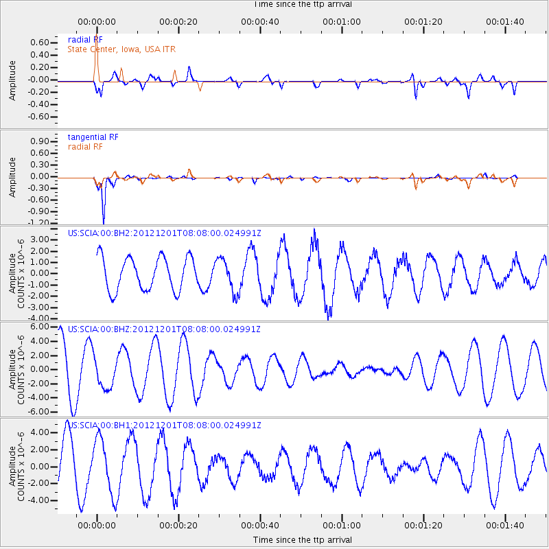
SCIA State Center, Iowa, USA - Earthquake Result Viewer
*The percent match for this event was below the threshold and hence no stack was calculated.
| Earthquake location: |
Alaska Peninsula |
| Earthquake latitude/longitude: |
58.4/-154.1 |
| Earthquake time(UTC): |
2012/12/01 (336) 08:00:57 GMT |
| Earthquake Depth: |
92 km |
| Earthquake Magnitude: |
5.5 MB, 5.3 MW, 5.4 MW |
| Earthquake Catalog/Contributor: |
WHDF/NEIC |
|
| Network: |
US United States National Seismic Network |
| Station: |
SCIA State Center, Iowa, USA |
| Lat/Lon: |
41.91 N/93.22 W |
| Elevation: |
312 m |
|
| Distance: |
40.8 deg |
| Az: |
86.358 deg |
| Baz: |
315.29 deg |
| Ray Param: |
$rayparam |
*The percent match for this event was below the threshold and hence was not used in the summary stack. |
|
| Radial Match: |
78.162575 % |
| Radial Bump: |
400 |
| Transverse Match: |
96.246376 % |
| Transverse Bump: |
153 |
| SOD ConfigId: |
558545 |
| Insert Time: |
2013-09-18 00:45:56.541 +0000 |
| GWidth: |
2.5 |
| Max Bumps: |
400 |
| Tol: |
0.001 |
|
Signal To Noise
| Channel | StoN | STA | LTA |
| US:SCIA:00:BHZ:20121201T08:08:00.024991Z | 0.5941575 | 2.0655227E-6 | 3.4763893E-6 |
| US:SCIA:00:BH1:20121201T08:08:00.024991Z | 1.2842461 | 3.3180484E-6 | 2.5836548E-6 |
| US:SCIA:00:BH2:20121201T08:08:00.024991Z | 1.0379777 | 1.491887E-6 | 1.4373018E-6 |
| Arrivals |
| Ps | |
| PpPs | |
| PsPs/PpSs | |


