You are here: Home > Network List > US - United States National Seismic Network Stations List
> Station MSO Missoula, Montana, USA > Earthquake Result Viewer
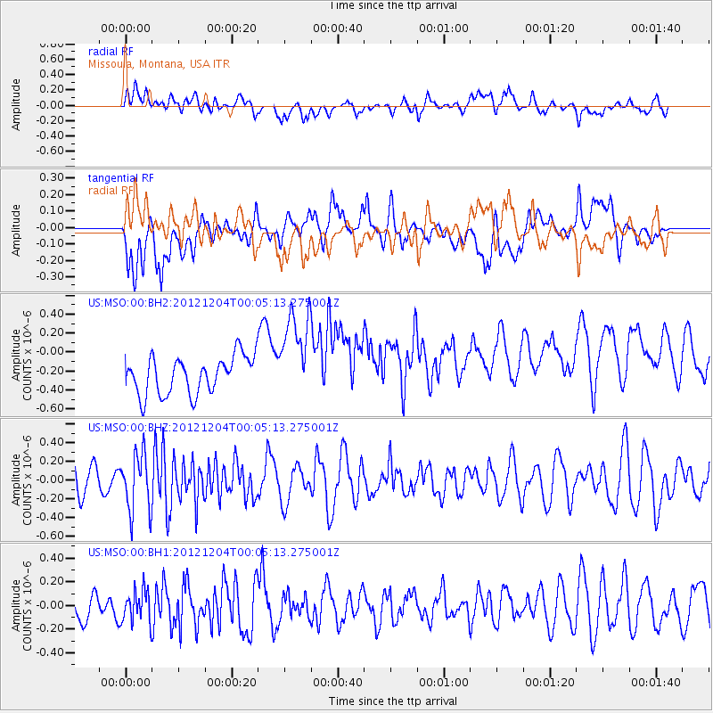
MSO Missoula, Montana, USA - Earthquake Result Viewer
*The percent match for this event was below the threshold and hence no stack was calculated.
| Earthquake location: |
Near Coast Of Chiapas, Mexico |
| Earthquake latitude/longitude: |
14.2/-92.4 |
| Earthquake time(UTC): |
2012/12/03 (338) 23:58:35 GMT |
| Earthquake Depth: |
35 km |
| Earthquake Magnitude: |
5.6 MD |
| Earthquake Catalog/Contributor: |
NEIC PDE/NEIC PDE-W |
|
| Network: |
US United States National Seismic Network |
| Station: |
MSO Missoula, Montana, USA |
| Lat/Lon: |
46.83 N/113.94 W |
| Elevation: |
1264 m |
|
| Distance: |
37.2 deg |
| Az: |
335.348 deg |
| Baz: |
143.895 deg |
| Ray Param: |
$rayparam |
*The percent match for this event was below the threshold and hence was not used in the summary stack. |
|
| Radial Match: |
56.565117 % |
| Radial Bump: |
400 |
| Transverse Match: |
56.750404 % |
| Transverse Bump: |
400 |
| SOD ConfigId: |
558545 |
| Insert Time: |
2013-09-18 00:58:47.634 +0000 |
| GWidth: |
2.5 |
| Max Bumps: |
400 |
| Tol: |
0.001 |
|
Signal To Noise
| Channel | StoN | STA | LTA |
| US:MSO:00:BHZ:20121204T00:05:13.275001Z | 2.1620727 | 3.1028085E-7 | 1.4351083E-7 |
| US:MSO:00:BH1:20121204T00:05:13.275001Z | 1.1326039 | 1.362694E-7 | 1.2031515E-7 |
| US:MSO:00:BH2:20121204T00:05:13.275001Z | 2.459315 | 4.8680613E-7 | 1.9794379E-7 |
| Arrivals |
| Ps | |
| PpPs | |
| PsPs/PpSs | |


