You are here: Home > Network List > IU - Global Seismograph Network (GSN - IRIS/USGS) Stations List
> Station PMG Port Moresby, New Guinea > Earthquake Result Viewer
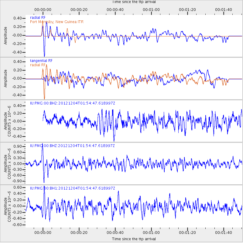
PMG Port Moresby, New Guinea - Earthquake Result Viewer
*The percent match for this event was below the threshold and hence no stack was calculated.
| Earthquake location: |
Southern Alaska |
| Earthquake latitude/longitude: |
61.2/-150.8 |
| Earthquake time(UTC): |
2012/12/04 (339) 01:42:48 GMT |
| Earthquake Depth: |
62 km |
| Earthquake Magnitude: |
5.6 MB, 5.8 MW, 5.7 MW |
| Earthquake Catalog/Contributor: |
WHDF/NEIC |
|
| Network: |
IU Global Seismograph Network (GSN - IRIS/USGS) |
| Station: |
PMG Port Moresby, New Guinea |
| Lat/Lon: |
9.40 S/147.16 E |
| Elevation: |
90 m |
|
| Distance: |
85.3 deg |
| Az: |
241.02 deg |
| Baz: |
25.391 deg |
| Ray Param: |
$rayparam |
*The percent match for this event was below the threshold and hence was not used in the summary stack. |
|
| Radial Match: |
62.614758 % |
| Radial Bump: |
400 |
| Transverse Match: |
51.214523 % |
| Transverse Bump: |
400 |
| SOD ConfigId: |
558545 |
| Insert Time: |
2013-09-18 01:01:52.215 +0000 |
| GWidth: |
2.5 |
| Max Bumps: |
400 |
| Tol: |
0.001 |
|
Signal To Noise
| Channel | StoN | STA | LTA |
| IU:PMG:00:BHZ:20121204T01:54:47.618997Z | 7.1781845 | 4.575459E-7 | 6.374117E-8 |
| IU:PMG:00:BH1:20121204T01:54:47.618997Z | 2.982007 | 2.862035E-7 | 9.5976795E-8 |
| IU:PMG:00:BH2:20121204T01:54:47.618997Z | 2.400006 | 2.0365815E-7 | 8.485735E-8 |
| Arrivals |
| Ps | |
| PpPs | |
| PsPs/PpSs | |


