You are here: Home > Network List > US - United States National Seismic Network Stations List
> Station WMOK Wichita Mountains, Oklahoma, USA > Earthquake Result Viewer
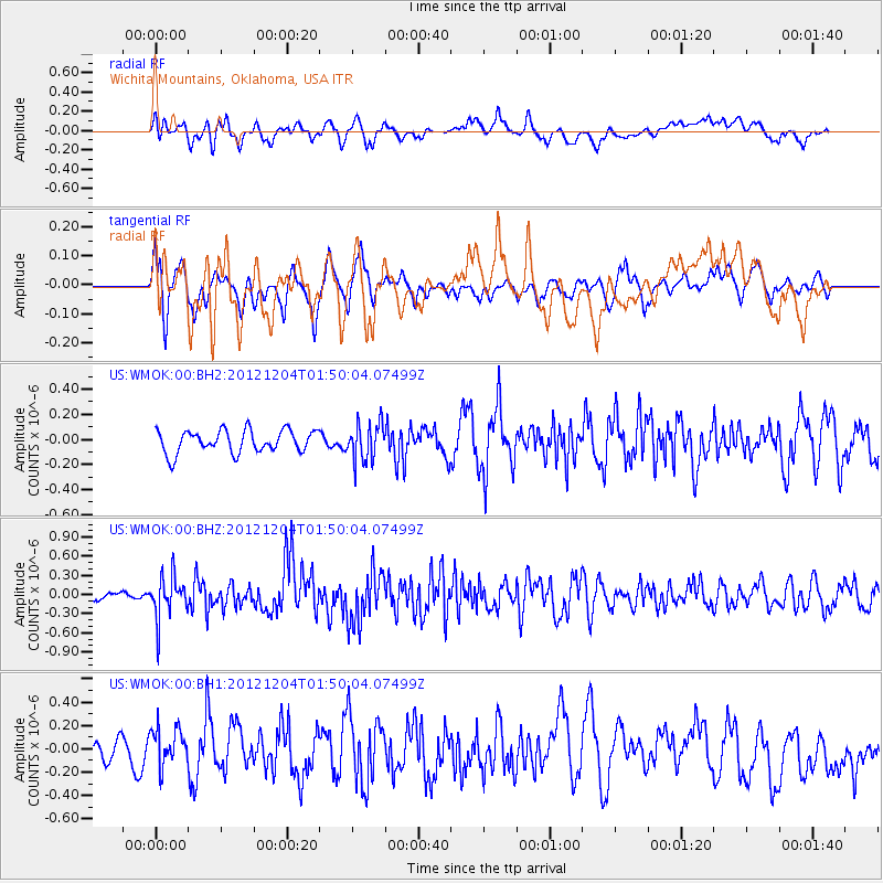
WMOK Wichita Mountains, Oklahoma, USA - Earthquake Result Viewer
*The percent match for this event was below the threshold and hence no stack was calculated.
| Earthquake location: |
Southern Alaska |
| Earthquake latitude/longitude: |
61.2/-150.8 |
| Earthquake time(UTC): |
2012/12/04 (339) 01:42:48 GMT |
| Earthquake Depth: |
62 km |
| Earthquake Magnitude: |
5.6 MB, 5.8 MW, 5.7 MW |
| Earthquake Catalog/Contributor: |
WHDF/NEIC |
|
| Network: |
US United States National Seismic Network |
| Station: |
WMOK Wichita Mountains, Oklahoma, USA |
| Lat/Lon: |
34.74 N/98.78 W |
| Elevation: |
486 m |
|
| Distance: |
42.1 deg |
| Az: |
104.652 deg |
| Baz: |
325.375 deg |
| Ray Param: |
$rayparam |
*The percent match for this event was below the threshold and hence was not used in the summary stack. |
|
| Radial Match: |
61.14954 % |
| Radial Bump: |
400 |
| Transverse Match: |
67.704636 % |
| Transverse Bump: |
400 |
| SOD ConfigId: |
558545 |
| Insert Time: |
2013-09-18 01:05:20.665 +0000 |
| GWidth: |
2.5 |
| Max Bumps: |
400 |
| Tol: |
0.001 |
|
Signal To Noise
| Channel | StoN | STA | LTA |
| US:WMOK:00:BHZ:20121204T01:50:04.07499Z | 2.1579099 | 3.3130084E-7 | 1.5352857E-7 |
| US:WMOK:00:BH1:20121204T01:50:04.07499Z | 1.7459221 | 1.6266188E-7 | 9.316675E-8 |
| US:WMOK:00:BH2:20121204T01:50:04.07499Z | 1.6728729 | 1.4989143E-7 | 8.960121E-8 |
| Arrivals |
| Ps | |
| PpPs | |
| PsPs/PpSs | |


