You are here: Home > Network List > II - Global Seismograph Network (GSN - IRIS/IDA) Stations List
> Station WRAB Tennant Creek, NT, Australia > Earthquake Result Viewer
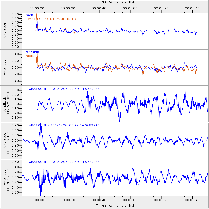
WRAB Tennant Creek, NT, Australia - Earthquake Result Viewer
*The percent match for this event was below the threshold and hence no stack was calculated.
| Earthquake location: |
Philippine Islands Region |
| Earthquake latitude/longitude: |
11.0/126.6 |
| Earthquake time(UTC): |
2012/12/06 (341) 00:43:24 GMT |
| Earthquake Depth: |
31 km |
| Earthquake Magnitude: |
5.5 MW |
| Earthquake Catalog/Contributor: |
NEIC PDE/NEIC PDE-W |
|
| Network: |
II Global Seismograph Network (GSN - IRIS/IDA) |
| Station: |
WRAB Tennant Creek, NT, Australia |
| Lat/Lon: |
19.93 S/134.36 E |
| Elevation: |
366 m |
|
| Distance: |
31.6 deg |
| Az: |
166.056 deg |
| Baz: |
345.433 deg |
| Ray Param: |
$rayparam |
*The percent match for this event was below the threshold and hence was not used in the summary stack. |
|
| Radial Match: |
71.37012 % |
| Radial Bump: |
400 |
| Transverse Match: |
45.570633 % |
| Transverse Bump: |
400 |
| SOD ConfigId: |
558545 |
| Insert Time: |
2013-09-18 01:11:20.745 +0000 |
| GWidth: |
2.5 |
| Max Bumps: |
400 |
| Tol: |
0.001 |
|
Signal To Noise
| Channel | StoN | STA | LTA |
| II:WRAB:00:BHZ:20121206T00:49:14.068994Z | 3.4863756 | 4.1504993E-7 | 1.1904911E-7 |
| II:WRAB:00:BH1:20121206T00:49:14.068994Z | 3.2651029 | 2.6080716E-7 | 7.987716E-8 |
| II:WRAB:00:BH2:20121206T00:49:14.068994Z | 1.6139708 | 1.1323895E-7 | 7.016171E-8 |
| Arrivals |
| Ps | |
| PpPs | |
| PsPs/PpSs | |


