
KEV Kevo, Finland - Earthquake Result Viewer
| ||||||||||||||||||
| ||||||||||||||||||
| ||||||||||||||||||
|
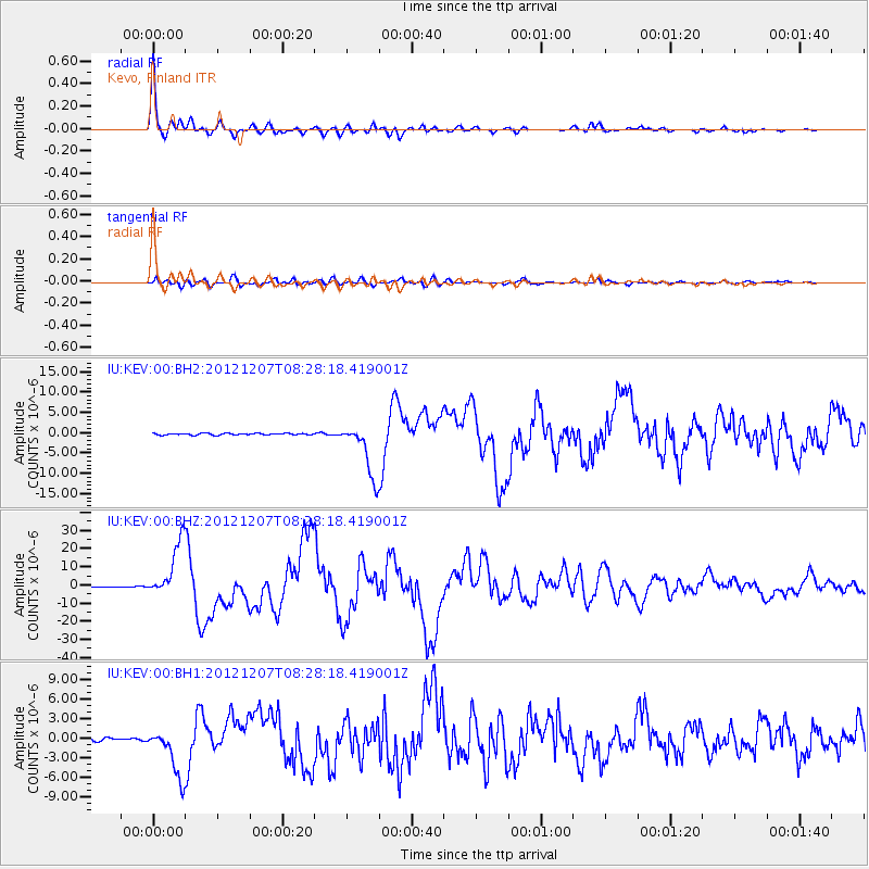
Signal To Noise
| Channel | StoN | STA | LTA |
| IU:KEV:00:BHZ:20121207T08:28:18.419001Z | 56.49394 | 1.521759E-5 | 2.6936678E-7 |
| IU:KEV:00:BH1:20121207T08:28:18.419001Z | 17.519228 | 3.766598E-6 | 2.1499794E-7 |
| IU:KEV:00:BH2:20121207T08:28:18.419001Z | 34.15586 | 6.7464293E-6 | 1.9751894E-7 |
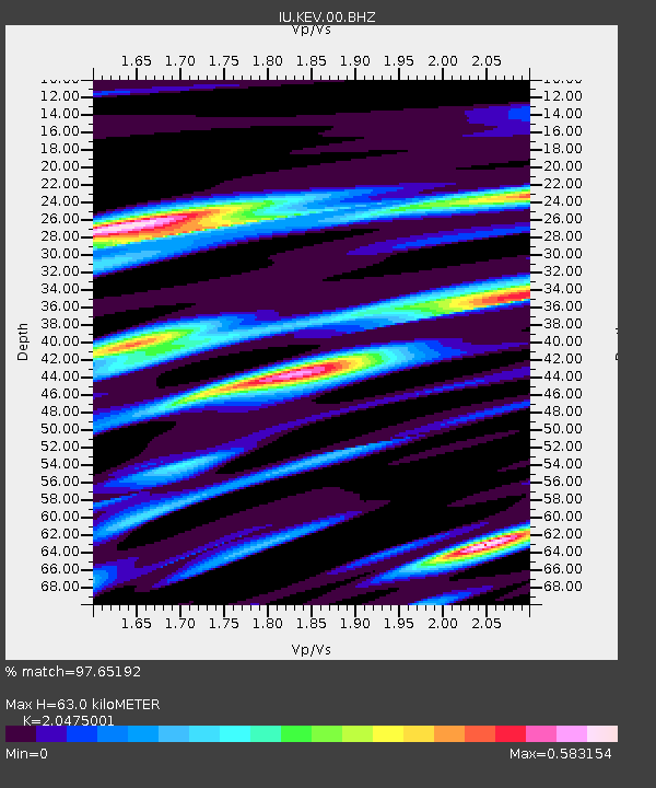
| Arrivals | |
| Ps | 10 SECOND |
| PpPs | 28 SECOND |
| PsPs/PpSs | 38 SECOND |

