
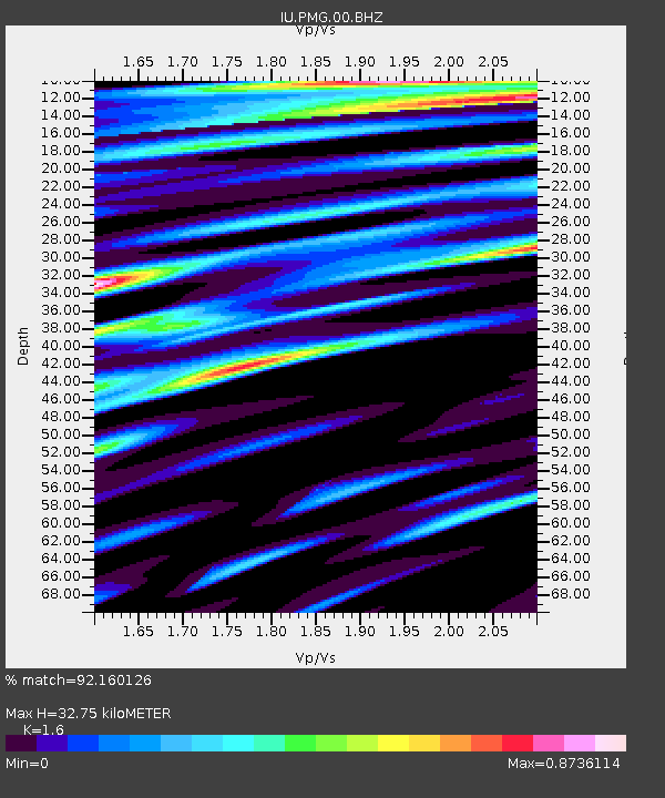
PMG Port Moresby, New Guinea - Earthquake Result Viewer
| ||||||||||||||||||
| ||||||||||||||||||
| ||||||||||||||||||
|
Signal To Noise
| Channel | StoN | STA | LTA |
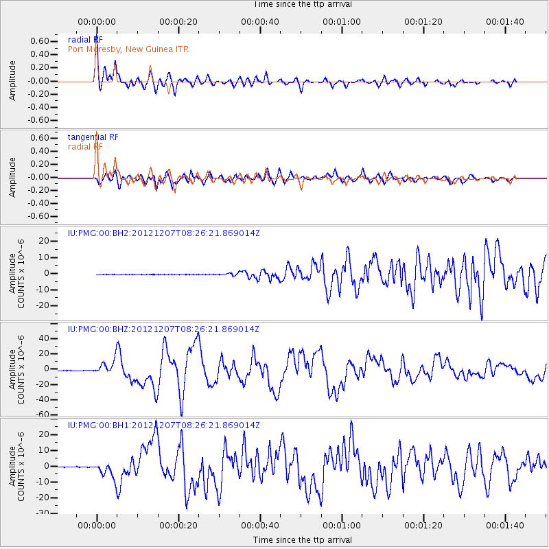
| IU:PMG:00:BHZ:20121207T08:26:21.869014Z | 52.50494 | 9.808534E-6 | 1.8681165E-7 |
| IU:PMG:00:BH1:20121207T08:26:21.869014Z | 26.330244 | 5.0965323E-6 | 1.935619E-7 |
| IU:PMG:00:BH2:20121207T08:26:21.869014Z | 4.27367 | 6.692936E-7 | 1.5660862E-7 |
| Arrivals | |
| Ps | 3.4 SECOND |
| PpPs | 13 SECOND |
| PsPs/PpSs | 16 SECOND |

