
RSSD Black Hills, South Dakota, USA - Earthquake Result Viewer
| ||||||||||||||||||
| ||||||||||||||||||
| ||||||||||||||||||
|
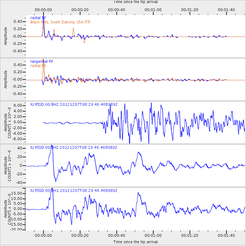
Signal To Noise
| Channel | StoN | STA | LTA |
| IU:RSSD:00:BHZ:20121207T08:29:46.468989Z | 114.76831 | 2.1787935E-5 | 1.8984278E-7 |
| IU:RSSD:00:BH1:20121207T08:29:46.468989Z | 65.78595 | 9.034363E-6 | 1.3732968E-7 |
| IU:RSSD:00:BH2:20121207T08:29:46.468989Z | 7.4756126 | 1.0709349E-6 | 1.4325714E-7 |
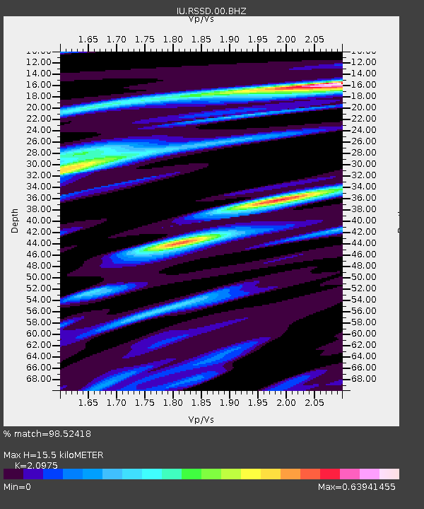
| Arrivals | |
| Ps | 2.8 SECOND |
| PpPs | 7.5 SECOND |
| PsPs/PpSs | 10 SECOND |

