SNZO South Karori, New Zealand - Earthquake Result Viewer
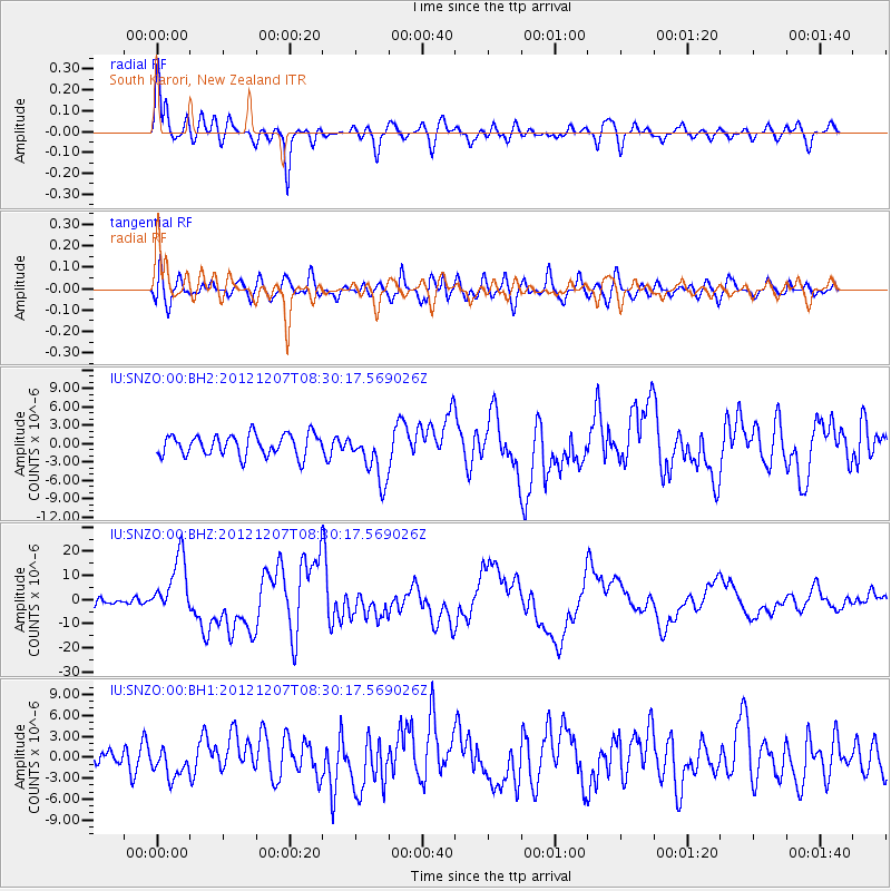
Earthquake location: Off East Coast Of Honshu, Japan
Earthquake latitude/longitude: 37.9/143.9
Earthquake time(UTC): 2012/12/07 (342) 08:18:23 GMT
Earthquake Depth: 31 km
Earthquake Magnitude: 7.2 MB, 7.3 MS, 7.3 MW, 7.3 MW
Earthquake Catalog/Contributor: WHDF/NEIC
Network: IU Global Seismograph Network (GSN - IRIS/USGS)
Station: SNZO South Karori, New Zealand
Lat/Lon: 41.31 S/174.70 E
Elevation: 120 m
Distance: 83.7 deg
Az: 157.195 deg
Baz: 335.98 deg
Ray Param: 0.04597394
Estimated Moho Depth: 39.0 km
Estimated Crust Vp/Vs: 1.66
Assumed Crust Vp: 6.461 km/s
Estimated Crust Vs: 3.887 km/s
Estimated Crust Poisson's Ratio: 0.22
Radial Match: 83.45573 %
Radial Bump: 400
Transverse Match: 74.08992 %
Transverse Bump: 400
SOD ConfigId: 558545
Insert Time: 2013-09-18 01:16:40.046 +0000
GWidth: 2.5
Max Bumps: 400
Tol: 0.001

Signal To Noise

ChannelStoNSTALTA
IU:SNZO:00:BHZ:20121207T08:30:17.569026Z7.9744381.2183981E-51.5278796E-6
IU:SNZO:00:BH1:20121207T08:30:17.569026Z1.32430482.0930527E-61.5804916E-6
IU:SNZO:00:BH2:20121207T08:30:17.569026Z2.38174754.1440717E-61.739929E-6
Arrivals
Ps4.1 SECOND
PpPs16 SECOND
PsPs/PpSs20 SECOND