
ACSO Alum Creek State Park, Ohio, USA - Earthquake Result Viewer
| ||||||||||||||||||
| ||||||||||||||||||
| ||||||||||||||||||
|
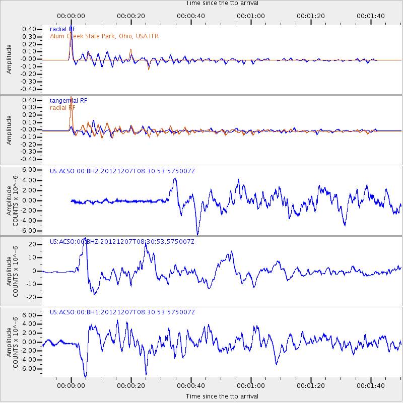
Signal To Noise
| Channel | StoN | STA | LTA |
| US:ACSO:00:BHZ:20121207T08:30:53.575007Z | 38.947956 | 1.1439611E-5 | 2.937153E-7 |
| US:ACSO:00:BH1:20121207T08:30:53.575007Z | 11.969506 | 3.0981564E-6 | 2.5883745E-7 |
| US:ACSO:00:BH2:20121207T08:30:53.575007Z | 11.063581 | 1.9427694E-6 | 1.7560039E-7 |
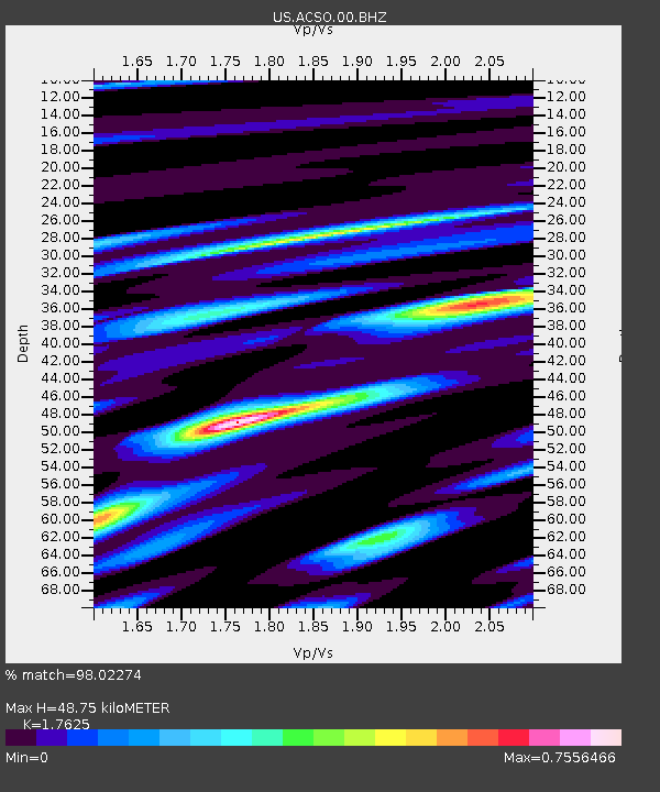
| Arrivals | |
| Ps | 5.8 SECOND |
| PpPs | 20 SECOND |
| PsPs/PpSs | 26 SECOND |

