AGMN Agassiz National Wildlife Refuge, Minnesota, USA - Earthquake Result Viewer
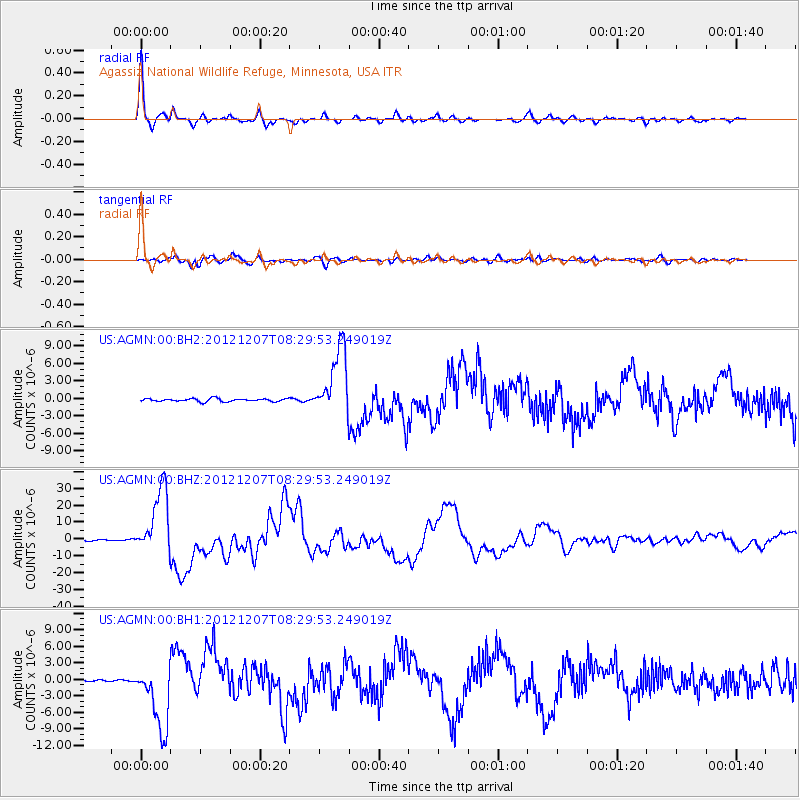
Earthquake location: Off East Coast Of Honshu, Japan
Earthquake latitude/longitude: 37.9/143.9
Earthquake time(UTC): 2012/12/07 (342) 08:18:23 GMT
Earthquake Depth: 31 km
Earthquake Magnitude: 7.2 MB, 7.3 MS, 7.3 MW, 7.3 MW
Earthquake Catalog/Contributor: WHDF/NEIC
Network: US United States National Seismic Network
Station: AGMN Agassiz National Wildlife Refuge, Minnesota, USA
Lat/Lon: 48.30 N/95.86 W
Elevation: 351 m
Distance: 79.1 deg
Az: 36.004 deg
Baz: 315.852 deg
Ray Param: 0.04917061
Estimated Moho Depth: 48.75 km
Estimated Crust Vp/Vs: 1.69
Assumed Crust Vp: 6.419 km/s
Estimated Crust Vs: 3.798 km/s
Estimated Crust Poisson's Ratio: 0.23
Radial Match: 98.28056 %
Radial Bump: 370
Transverse Match: 94.508194 %
Transverse Bump: 400
SOD ConfigId: 558545
Insert Time: 2013-09-18 01:17:27.859 +0000
GWidth: 2.5
Max Bumps: 400
Tol: 0.001

Signal To Noise

ChannelStoNSTALTA
US:AGMN:00:BHZ:20121207T08:29:53.249019Z59.4722251.994699E-53.3540007E-7
US:AGMN:00:BH1:20121207T08:29:53.249019Z26.998756.0574916E-62.2436193E-7
US:AGMN:00:BH2:20121207T08:29:53.249019Z22.4294825.857304E-62.611431E-7
Arrivals
Ps5.4 SECOND
PpPs20 SECOND
PsPs/PpSs25 SECOND