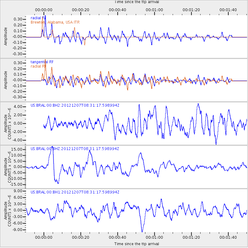
BRAL Brewton, Alabama, USA - Earthquake Result Viewer
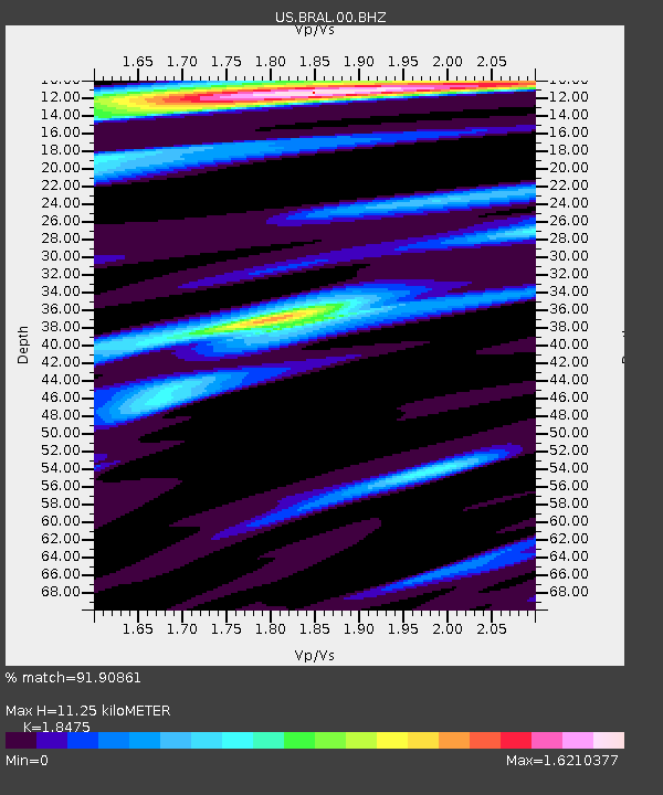
Earthquake location: Off East Coast Of Honshu, Japan
Earthquake latitude/longitude: 37.9/143.9
Earthquake time(UTC): 2012/12/07 (342) 08:18:23 GMT
Earthquake Depth: 31 km
Earthquake Magnitude: 7.2 MB, 7.3 MS, 7.3 MW, 7.3 MW
Earthquake Catalog/Contributor: WHDF/NEIC
Network: US United States National Seismic Network
Station: BRAL Brewton, Alabama, USA
Lat/Lon: 31.01 N/87.06 W
Elevation: 61 m
Distance: 96.5 deg
Az: 42.196 deg
Baz: 321.761 deg
Ray Param: 0.040470093
Estimated Moho Depth: 11.25 km
Estimated Crust Vp/Vs: 1.85
Assumed Crust Vp: 6.187 km/s
Estimated Crust Vs: 3.349 km/s
Estimated Crust Poisson's Ratio: 0.29
Radial Match: 91.90861 %
Radial Bump: 400
Transverse Match: 74.00092 %
Transverse Bump: 400
SOD ConfigId: 558545
Insert Time: 2013-09-18 01:17:48.727 +0000
GWidth: 2.5
Max Bumps: 400
Tol: 0.001

Signal To Noise

ChannelStoNSTALTA
US:BRAL:00:BHZ:20121207T08:31:17.598994Z12.8401098.719267E-66.7906484E-7
US:BRAL:00:BH1:20121207T08:31:17.598994Z2.10499382.0023276E-69.512273E-7
US:BRAL:00:BH2:20121207T08:31:17.598994Z1.87726691.2420903E-66.6164824E-7
Arrivals
Ps1.6 SECOND
PpPs5.1 SECOND
PsPs/PpSs6.7 SECOND