
EGMT Eagleton, Montana, USA - Earthquake Result Viewer
| ||||||||||||||||||
| ||||||||||||||||||
| ||||||||||||||||||
|
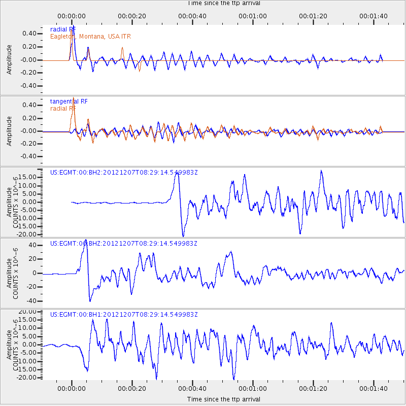
Signal To Noise
| Channel | StoN | STA | LTA |
| US:EGMT:00:BHZ:20121207T08:29:14.549983Z | 129.96378 | 2.1709959E-5 | 1.6704622E-7 |
| US:EGMT:00:BH1:20121207T08:29:14.549983Z | 21.733412 | 5.5109126E-6 | 2.535687E-7 |
| US:EGMT:00:BH2:20121207T08:29:14.549983Z | 32.85964 | 7.3143487E-6 | 2.2259371E-7 |
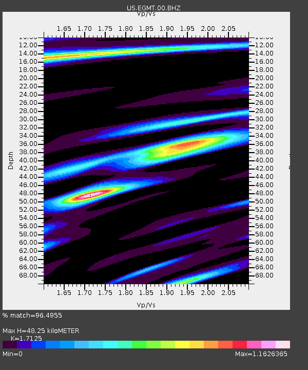
| Arrivals | |
| Ps | 5.5 SECOND |
| PpPs | 20 SECOND |
| PsPs/PpSs | 25 SECOND |

