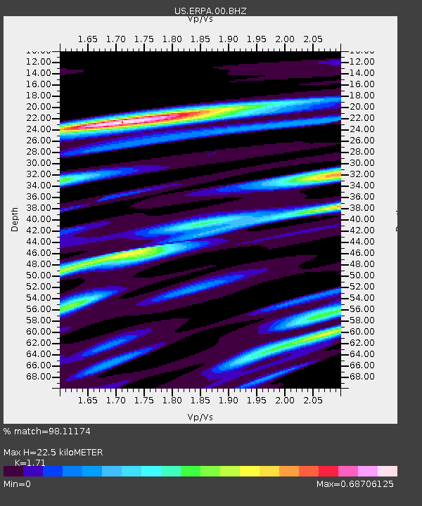
ERPA Erie, Pennsylvania, USA - Earthquake Result Viewer

Earthquake location: Off East Coast Of Honshu, Japan
Earthquake latitude/longitude: 37.9/143.9
Earthquake time(UTC): 2012/12/07 (342) 08:18:23 GMT
Earthquake Depth: 31 km
Earthquake Magnitude: 7.2 MB, 7.3 MS, 7.3 MW, 7.3 MW
Earthquake Catalog/Contributor: WHDF/NEIC
Network: US United States National Seismic Network
Station: ERPA Erie, Pennsylvania, USA
Lat/Lon: 42.12 N/79.99 W
Elevation: 306 m
Distance: 90.9 deg
Az: 31.085 deg
Baz: 326.698 deg
Ray Param: 0.04163873
Estimated Moho Depth: 22.5 km
Estimated Crust Vp/Vs: 1.71
Assumed Crust Vp: 6.419 km/s
Estimated Crust Vs: 3.754 km/s
Estimated Crust Poisson's Ratio: 0.24
Radial Match: 98.11174 %
Radial Bump: 326
Transverse Match: 88.65309 %
Transverse Bump: 400
SOD ConfigId: 558545
Insert Time: 2013-09-18 01:18:32.049 +0000
GWidth: 2.5
Max Bumps: 400
Tol: 0.001

Signal To Noise

ChannelStoNSTALTA
US:ERPA:00:BHZ:20121207T08:30:52.27502Z39.8319241.2977262E-53.2580053E-7
US:ERPA:00:BH1:20121207T08:30:52.27502Z11.0267513.4265724E-63.1075086E-7
US:ERPA:00:BH2:20121207T08:30:52.27502Z10.74531652.143509E-61.994831E-7
Arrivals
Ps2.5 SECOND
PpPs9.3 SECOND
PsPs/PpSs12 SECOND