KSU1 Kansas State University--Konza Prairie, Kansas, USA - Earthquake Result Viewer
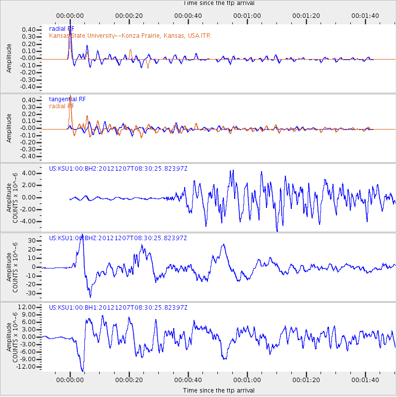
Earthquake location: Off East Coast Of Honshu, Japan
Earthquake latitude/longitude: 37.9/143.9
Earthquake time(UTC): 2012/12/07 (342) 08:18:23 GMT
Earthquake Depth: 31 km
Earthquake Magnitude: 7.2 MB, 7.3 MS, 7.3 MW, 7.3 MW
Earthquake Catalog/Contributor: WHDF/NEIC
Network: US United States National Seismic Network
Station: KSU1 Kansas State University--Konza Prairie, Kansas, USA
Lat/Lon: 39.10 N/96.61 W
Elevation: 347 m
Distance: 85.3 deg
Az: 42.834 deg
Baz: 316.266 deg
Ray Param: 0.044808105
Estimated Moho Depth: 43.5 km
Estimated Crust Vp/Vs: 1.84
Assumed Crust Vp: 6.483 km/s
Estimated Crust Vs: 3.528 km/s
Estimated Crust Poisson's Ratio: 0.29
Radial Match: 97.13699 %
Radial Bump: 400
Transverse Match: 90.49445 %
Transverse Bump: 400
SOD ConfigId: 558545
Insert Time: 2013-09-18 01:19:15.669 +0000
GWidth: 2.5
Max Bumps: 400
Tol: 0.001

Signal To Noise

ChannelStoNSTALTA
US:KSU1:00:BHZ:20121207T08:30:25.82397Z95.869681.8301778E-51.9090267E-7
US:KSU1:00:BH1:20121207T08:30:25.82397Z21.6213916.5521785E-63.030415E-7
US:KSU1:00:BH2:20121207T08:30:25.82397Z0.67529991.1021192E-71.6320442E-7
Arrivals
Ps5.8 SECOND
PpPs19 SECOND
PsPs/PpSs24 SECOND