NATX Nacogdoches, Texas, USA - Earthquake Result Viewer
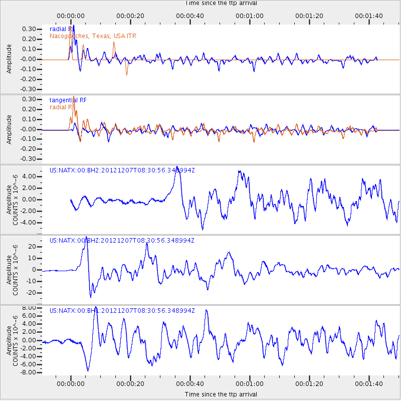
Earthquake location: Off East Coast Of Honshu, Japan
Earthquake latitude/longitude: 37.9/143.9
Earthquake time(UTC): 2012/12/07 (342) 08:18:23 GMT
Earthquake Depth: 31 km
Earthquake Magnitude: 7.2 MB, 7.3 MS, 7.3 MW, 7.3 MW
Earthquake Catalog/Contributor: WHDF/NEIC
Network: US United States National Seismic Network
Station: NATX Nacogdoches, Texas, USA
Lat/Lon: 31.76 N/94.66 W
Elevation: 156 m
Distance: 91.8 deg
Az: 46.678 deg
Baz: 317.491 deg
Ray Param: 0.041553468
Estimated Moho Depth: 17.75 km
Estimated Crust Vp/Vs: 1.62
Assumed Crust Vp: 5.738 km/s
Estimated Crust Vs: 3.537 km/s
Estimated Crust Poisson's Ratio: 0.19
Radial Match: 93.31126 %
Radial Bump: 397
Transverse Match: 83.60763 %
Transverse Bump: 400
SOD ConfigId: 558545
Insert Time: 2013-09-18 01:19:53.258 +0000
GWidth: 2.5
Max Bumps: 400
Tol: 0.001

Signal To Noise

ChannelStoNSTALTA
US:NATX:00:BHZ:20121207T08:30:56.348994Z33.4096269.174997E-62.7462136E-7
US:NATX:00:BH1:20121207T08:30:56.348994Z4.5810561.2604067E-62.7513454E-7
US:NATX:00:BH2:20121207T08:30:56.348994Z3.0112351.4716366E-64.887153E-7
Arrivals
Ps2.0 SECOND
PpPs8.0 SECOND
PsPs/PpSs9.9 SECOND