You are here: Home > Network List > US - United States National Seismic Network Stations List
> Station HAWA Hanford, Washington, USA > Earthquake Result Viewer
HAWA Hanford, Washington, USA - Earthquake Result Viewer
*The percent match for this event was below the threshold and hence no stack was calculated.
| Earthquake location: |
Eastern New Guinea Reg., P.N.G. |
| Earthquake latitude/longitude: |
-7.7/147.0 |
| Earthquake time(UTC): |
2012/12/07 (342) 19:50:23 GMT |
| Earthquake Depth: |
140 km |
| Earthquake Magnitude: |
5.5 MB, 5.7 MW |
| Earthquake Catalog/Contributor: |
WHDF/NEIC |
|
| Network: |
US United States National Seismic Network |
| Station: |
HAWA Hanford, Washington, USA |
| Lat/Lon: |
46.39 N/119.53 W |
| Elevation: |
364 m |
|
| Distance: |
97.9 deg |
| Az: |
44.225 deg |
| Baz: |
267.233 deg |
| Ray Param: |
$rayparam |
*The percent match for this event was below the threshold and hence was not used in the summary stack. |
|
| Radial Match: |
34.82283 % |
| Radial Bump: |
400 |
| Transverse Match: |
48.21681 % |
| Transverse Bump: |
400 |
| SOD ConfigId: |
558545 |
| Insert Time: |
2013-09-18 01:33:30.317 +0000 |
| GWidth: |
2.5 |
| Max Bumps: |
400 |
| Tol: |
0.001 |
|
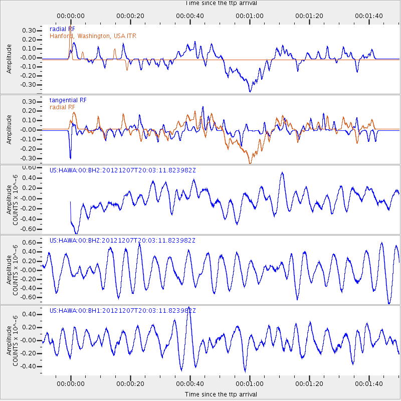
Signal To Noise
| Channel | StoN | STA | LTA |
| US:HAWA:00:BHZ:20121207T20:03:11.823982Z | 0.6392782 | 1.2131332E-7 | 1.897661E-7 |
| US:HAWA:00:BH1:20121207T20:03:11.823982Z | 1.1473434 | 1.4247486E-7 | 1.2417803E-7 |
| US:HAWA:00:BH2:20121207T20:03:11.823982Z | 1.5095507 | 2.879833E-7 | 1.9077419E-7 |
| Arrivals |
| Ps | |
| PpPs | |
| PsPs/PpSs | |


