You are here: Home > Network List > IU - Global Seismograph Network (GSN - IRIS/USGS) Stations List
> Station HNR Honiara, Solomon Islands > Earthquake Result Viewer
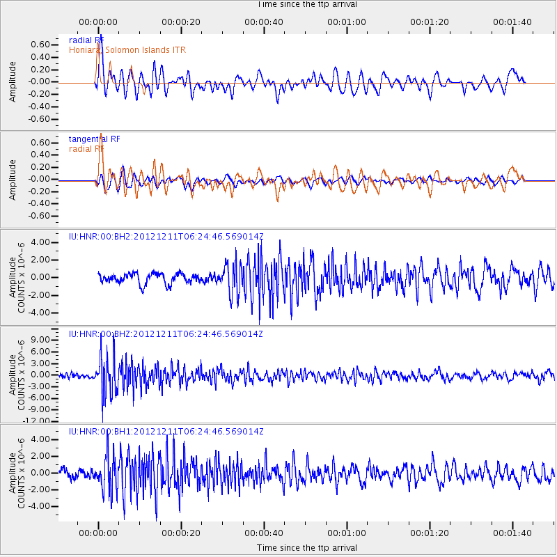
HNR Honiara, Solomon Islands - Earthquake Result Viewer
*The percent match for this event was below the threshold and hence no stack was calculated.
| Earthquake location: |
Northern Molucca Sea |
| Earthquake latitude/longitude: |
0.5/126.2 |
| Earthquake time(UTC): |
2012/12/11 (346) 06:18:27 GMT |
| Earthquake Depth: |
30 km |
| Earthquake Magnitude: |
6.0 MB, 5.7 MS, 6.0 MW, 5.9 MW |
| Earthquake Catalog/Contributor: |
WHDF/NEIC |
|
| Network: |
IU Global Seismograph Network (GSN - IRIS/USGS) |
| Station: |
HNR Honiara, Solomon Islands |
| Lat/Lon: |
9.44 S/159.95 E |
| Elevation: |
100 m |
|
| Distance: |
35.0 deg |
| Az: |
107.292 deg |
| Baz: |
284.605 deg |
| Ray Param: |
$rayparam |
*The percent match for this event was below the threshold and hence was not used in the summary stack. |
|
| Radial Match: |
74.40228 % |
| Radial Bump: |
400 |
| Transverse Match: |
72.77774 % |
| Transverse Bump: |
400 |
| SOD ConfigId: |
558545 |
| Insert Time: |
2013-09-18 01:46:21.878 +0000 |
| GWidth: |
2.5 |
| Max Bumps: |
400 |
| Tol: |
0.001 |
|
Signal To Noise
| Channel | StoN | STA | LTA |
| IU:HNR:00:BHZ:20121211T06:24:46.569014Z | 10.469712 | 5.0999893E-6 | 4.8711837E-7 |
| IU:HNR:00:BH1:20121211T06:24:46.569014Z | 4.556675 | 2.0475695E-6 | 4.4935607E-7 |
| IU:HNR:00:BH2:20121211T06:24:46.569014Z | 2.8896866 | 1.6627275E-6 | 5.7540063E-7 |
| Arrivals |
| Ps | |
| PpPs | |
| PsPs/PpSs | |


