You are here: Home > Network List > IU - Global Seismograph Network (GSN - IRIS/USGS) Stations List
> Station RSSD Black Hills, South Dakota, USA > Earthquake Result Viewer
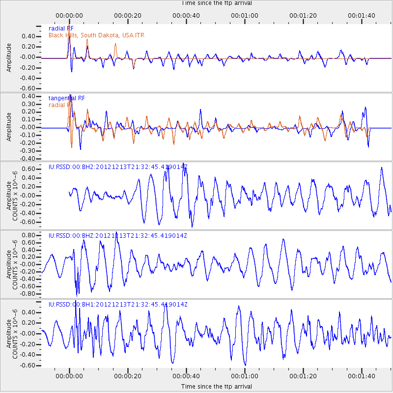
RSSD Black Hills, South Dakota, USA - Earthquake Result Viewer
*The percent match for this event was below the threshold and hence no stack was calculated.
| Earthquake location: |
El Salvador |
| Earthquake latitude/longitude: |
13.1/-90.0 |
| Earthquake time(UTC): |
2012/12/13 (348) 21:26:39 GMT |
| Earthquake Depth: |
10 km |
| Earthquake Magnitude: |
5.5 MB, 4.9 MS, 5.3 MW, 5.5 MW |
| Earthquake Catalog/Contributor: |
WHDF/NEIC |
|
| Network: |
IU Global Seismograph Network (GSN - IRIS/USGS) |
| Station: |
RSSD Black Hills, South Dakota, USA |
| Lat/Lon: |
44.12 N/104.04 W |
| Elevation: |
2090 m |
|
| Distance: |
33.2 deg |
| Az: |
341.36 deg |
| Baz: |
154.378 deg |
| Ray Param: |
$rayparam |
*The percent match for this event was below the threshold and hence was not used in the summary stack. |
|
| Radial Match: |
48.025608 % |
| Radial Bump: |
400 |
| Transverse Match: |
66.9142 % |
| Transverse Bump: |
392 |
| SOD ConfigId: |
558545 |
| Insert Time: |
2013-09-18 01:57:18.929 +0000 |
| GWidth: |
2.5 |
| Max Bumps: |
400 |
| Tol: |
0.001 |
|
Signal To Noise
| Channel | StoN | STA | LTA |
| IU:RSSD:00:BHZ:20121213T21:32:45.419014Z | 2.1290329 | 4.0193552E-7 | 1.8878785E-7 |
| IU:RSSD:00:BH1:20121213T21:32:45.419014Z | 1.7211744 | 2.3699256E-7 | 1.3769235E-7 |
| IU:RSSD:00:BH2:20121213T21:32:45.419014Z | 3.3944817 | 4.3794958E-7 | 1.290181E-7 |
| Arrivals |
| Ps | |
| PpPs | |
| PsPs/PpSs | |


