You are here: Home > Network List > US - United States National Seismic Network Stations List
> Station MSO Missoula, Montana, USA > Earthquake Result Viewer
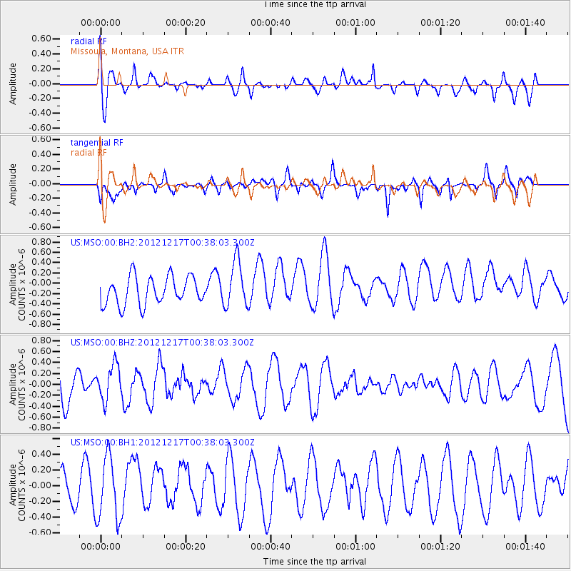
MSO Missoula, Montana, USA - Earthquake Result Viewer
*The percent match for this event was below the threshold and hence no stack was calculated.
| Earthquake location: |
Kuril Islands |
| Earthquake latitude/longitude: |
49.8/155.8 |
| Earthquake time(UTC): |
2012/12/17 (352) 00:28:58 GMT |
| Earthquake Depth: |
68 km |
| Earthquake Magnitude: |
5.6 MW, 5.6 MW |
| Earthquake Catalog/Contributor: |
NEIC PDE/NEIC PDE-W |
|
| Network: |
US United States National Seismic Network |
| Station: |
MSO Missoula, Montana, USA |
| Lat/Lon: |
46.83 N/113.94 W |
| Elevation: |
1264 m |
|
| Distance: |
56.5 deg |
| Az: |
55.422 deg |
| Baz: |
308.989 deg |
| Ray Param: |
$rayparam |
*The percent match for this event was below the threshold and hence was not used in the summary stack. |
|
| Radial Match: |
53.426044 % |
| Radial Bump: |
400 |
| Transverse Match: |
60.61985 % |
| Transverse Bump: |
400 |
| SOD ConfigId: |
558545 |
| Insert Time: |
2013-09-18 02:26:52.904 +0000 |
| GWidth: |
2.5 |
| Max Bumps: |
400 |
| Tol: |
0.001 |
|
Signal To Noise
| Channel | StoN | STA | LTA |
| US:MSO:00:BHZ:20121217T00:38:03.300Z | 0.83132875 | 3.262986E-7 | 3.9250247E-7 |
| US:MSO:00:BH1:20121217T00:38:03.300Z | 0.7181688 | 4.0234943E-7 | 5.6024356E-7 |
| US:MSO:00:BH2:20121217T00:38:03.300Z | 1.7188241 | 4.6295796E-7 | 2.6934575E-7 |
| Arrivals |
| Ps | |
| PpPs | |
| PsPs/PpSs | |


