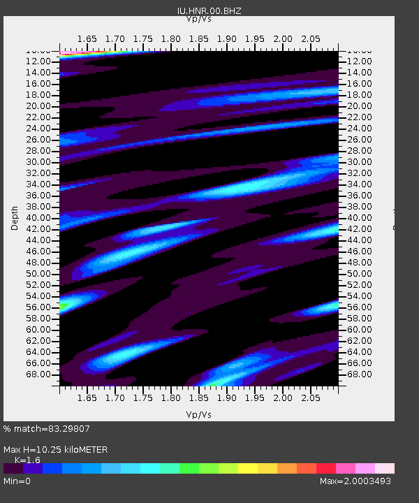
HNR Honiara, Solomon Islands - Earthquake Result Viewer
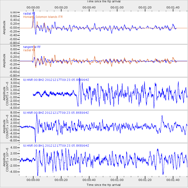
Earthquake location: Minahassa Peninsula, Sulawesi
Earthquake latitude/longitude: -0.6/123.8
Earthquake time(UTC): 2012/12/17 (352) 09:16:30 GMT
Earthquake Depth: 44 km
Earthquake Magnitude: 6.0 MB, 5.6 MS, 6.1 MW, 6.1 MW
Earthquake Catalog/Contributor: WHDF/NEIC
Network: IU Global Seismograph Network (GSN - IRIS/USGS)
Station: HNR Honiara, Solomon Islands
Lat/Lon: 9.44 S/159.95 E
Elevation: 100 m
Distance: 37.0 deg
Az: 104.819 deg
Baz: 281.545 deg
Ray Param: 0.07626863
Estimated Moho Depth: 10.25 km
Estimated Crust Vp/Vs: 1.60
Assumed Crust Vp: 6.183 km/s
Estimated Crust Vs: 3.864 km/s
Estimated Crust Poisson's Ratio: 0.18
Radial Match: 83.29807 %
Radial Bump: 400
Transverse Match: 81.43213 %
Transverse Bump: 334
SOD ConfigId: 558545
Insert Time: 2013-09-18 02:28:13.638 +0000
GWidth: 2.5
Max Bumps: 400
Tol: 0.001

Signal To Noise

ChannelStoNSTALTA
IU:HNR:00:BHZ:20121217T09:23:05.868994Z11.2294953.4534828E-63.075368E-7
IU:HNR:00:BH1:20121217T09:23:05.868994Z9.8519952.214198E-62.2474616E-7
IU:HNR:00:BH2:20121217T09:23:05.868994Z5.95491551.9623951E-63.2954205E-7
Arrivals
Ps1.1 SECOND
PpPs4.0 SECOND
PsPs/PpSs5.1 SECOND