You are here: Home > Network List > US - United States National Seismic Network Stations List
> Station MSO Missoula, Montana, USA > Earthquake Result Viewer
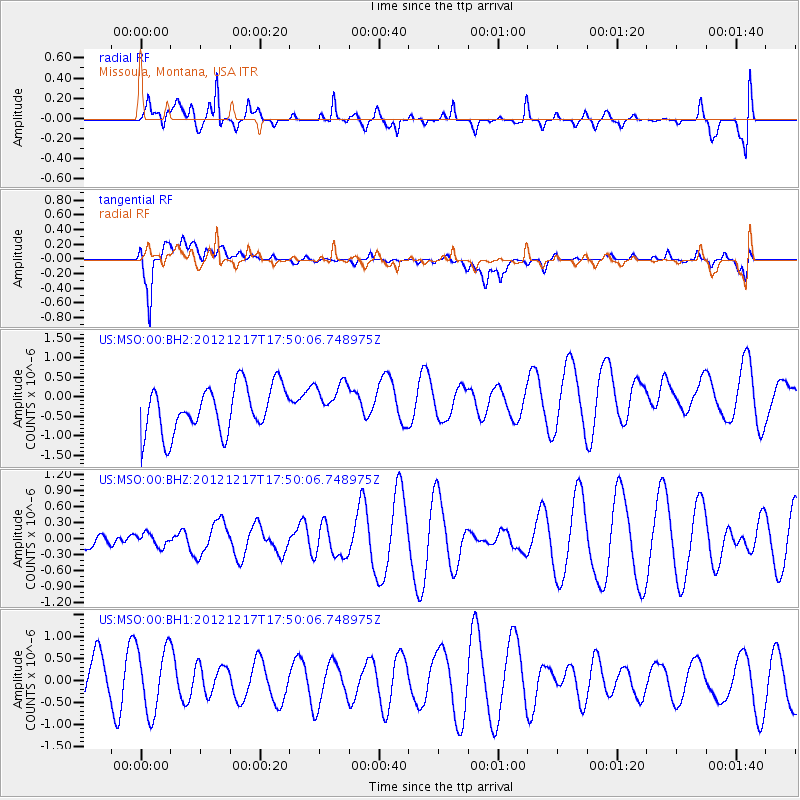
MSO Missoula, Montana, USA - Earthquake Result Viewer
*The percent match for this event was below the threshold and hence no stack was calculated.
| Earthquake location: |
Central East Pacific Rise |
| Earthquake latitude/longitude: |
-4.2/-104.5 |
| Earthquake time(UTC): |
2012/12/17 (352) 17:41:32 GMT |
| Earthquake Depth: |
10 km |
| Earthquake Magnitude: |
5.9 MW, 5.6 MS, 5.8 MW |
| Earthquake Catalog/Contributor: |
NEIC PDE/NEIC PDE-W |
|
| Network: |
US United States National Seismic Network |
| Station: |
MSO Missoula, Montana, USA |
| Lat/Lon: |
46.83 N/113.94 W |
| Elevation: |
1264 m |
|
| Distance: |
51.5 deg |
| Az: |
351.718 deg |
| Baz: |
167.923 deg |
| Ray Param: |
$rayparam |
*The percent match for this event was below the threshold and hence was not used in the summary stack. |
|
| Radial Match: |
65.33877 % |
| Radial Bump: |
400 |
| Transverse Match: |
64.87649 % |
| Transverse Bump: |
400 |
| SOD ConfigId: |
558545 |
| Insert Time: |
2013-09-18 02:32:14.572 +0000 |
| GWidth: |
2.5 |
| Max Bumps: |
400 |
| Tol: |
0.001 |
|
Signal To Noise
| Channel | StoN | STA | LTA |
| US:MSO:00:BHZ:20121217T17:50:06.748975Z | 0.31606343 | 1.1891169E-7 | 3.7622732E-7 |
| US:MSO:00:BH1:20121217T17:50:06.748975Z | 2.1226158 | 7.512092E-7 | 3.5390727E-7 |
| US:MSO:00:BH2:20121217T17:50:06.748975Z | 0.8613591 | 5.1431715E-7 | 5.970996E-7 |
| Arrivals |
| Ps | |
| PpPs | |
| PsPs/PpSs | |


