You are here: Home > Network List > IU - Global Seismograph Network (GSN - IRIS/USGS) Stations List
> Station HNR Honiara, Solomon Islands > Earthquake Result Viewer
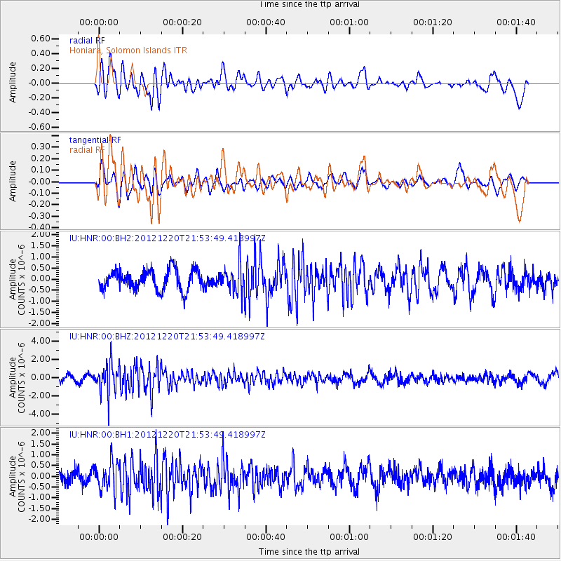
HNR Honiara, Solomon Islands - Earthquake Result Viewer
*The percent match for this event was below the threshold and hence no stack was calculated.
| Earthquake location: |
Northern Molucca Sea |
| Earthquake latitude/longitude: |
0.6/126.2 |
| Earthquake time(UTC): |
2012/12/20 (355) 21:47:29 GMT |
| Earthquake Depth: |
28 km |
| Earthquake Magnitude: |
5.7 MB, 4.9 MS, 5.4 MW |
| Earthquake Catalog/Contributor: |
WHDF/NEIC |
|
| Network: |
IU Global Seismograph Network (GSN - IRIS/USGS) |
| Station: |
HNR Honiara, Solomon Islands |
| Lat/Lon: |
9.44 S/159.95 E |
| Elevation: |
100 m |
|
| Distance: |
35.0 deg |
| Az: |
107.326 deg |
| Baz: |
284.645 deg |
| Ray Param: |
$rayparam |
*The percent match for this event was below the threshold and hence was not used in the summary stack. |
|
| Radial Match: |
53.32754 % |
| Radial Bump: |
400 |
| Transverse Match: |
53.605618 % |
| Transverse Bump: |
400 |
| SOD ConfigId: |
558545 |
| Insert Time: |
2013-09-18 02:37:50.836 +0000 |
| GWidth: |
2.5 |
| Max Bumps: |
400 |
| Tol: |
0.001 |
|
Signal To Noise
| Channel | StoN | STA | LTA |
| IU:HNR:00:BHZ:20121220T21:53:49.418997Z | 5.305695 | 1.7124364E-6 | 3.227544E-7 |
| IU:HNR:00:BH1:20121220T21:53:49.418997Z | 1.7512597 | 6.601612E-7 | 3.7696367E-7 |
| IU:HNR:00:BH2:20121220T21:53:49.418997Z | 1.3965061 | 6.2950437E-7 | 4.5077093E-7 |
| Arrivals |
| Ps | |
| PpPs | |
| PsPs/PpSs | |


