You are here: Home > Network List > US - United States National Seismic Network Stations List
> Station EGMT Eagleton, Montana, USA > Earthquake Result Viewer
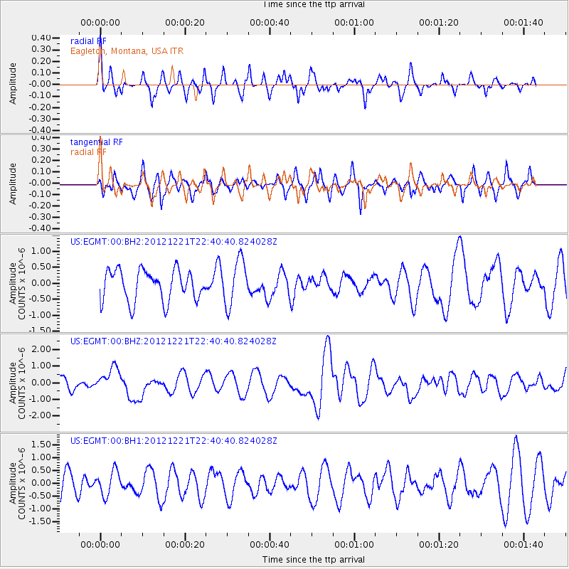
EGMT Eagleton, Montana, USA - Earthquake Result Viewer
*The percent match for this event was below the threshold and hence no stack was calculated.
| Earthquake location: |
Vanuatu Islands |
| Earthquake latitude/longitude: |
-14.3/167.3 |
| Earthquake time(UTC): |
2012/12/21 (356) 22:28:08 GMT |
| Earthquake Depth: |
201 km |
| Earthquake Magnitude: |
6.1 MB, 6.7 MW, 6.7 MW |
| Earthquake Catalog/Contributor: |
WHDF/NEIC |
|
| Network: |
US United States National Seismic Network |
| Station: |
EGMT Eagleton, Montana, USA |
| Lat/Lon: |
48.02 N/109.75 W |
| Elevation: |
1055 m |
|
| Distance: |
95.9 deg |
| Az: |
42.05 deg |
| Baz: |
255.246 deg |
| Ray Param: |
$rayparam |
*The percent match for this event was below the threshold and hence was not used in the summary stack. |
|
| Radial Match: |
48.39898 % |
| Radial Bump: |
390 |
| Transverse Match: |
52.89336 % |
| Transverse Bump: |
400 |
| SOD ConfigId: |
558545 |
| Insert Time: |
2013-09-18 02:41:55.438 +0000 |
| GWidth: |
2.5 |
| Max Bumps: |
400 |
| Tol: |
0.001 |
|
Signal To Noise
| Channel | StoN | STA | LTA |
| US:EGMT:00:BHZ:20121221T22:40:40.824028Z | 1.937683 | 7.658984E-7 | 3.9526506E-7 |
| US:EGMT:00:BH1:20121221T22:40:40.824028Z | 1.0988588 | 4.854164E-7 | 4.4174593E-7 |
| US:EGMT:00:BH2:20121221T22:40:40.824028Z | 1.5108849 | 7.274408E-7 | 4.814667E-7 |
| Arrivals |
| Ps | |
| PpPs | |
| PsPs/PpSs | |


