You are here: Home > Network List > US - United States National Seismic Network Stations List
> Station MSO Missoula, Montana, USA > Earthquake Result Viewer
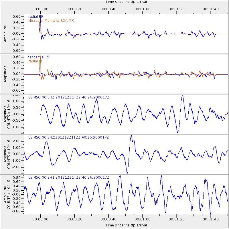
MSO Missoula, Montana, USA - Earthquake Result Viewer
*The percent match for this event was below the threshold and hence no stack was calculated.
| Earthquake location: |
Vanuatu Islands |
| Earthquake latitude/longitude: |
-14.3/167.3 |
| Earthquake time(UTC): |
2012/12/21 (356) 22:28:08 GMT |
| Earthquake Depth: |
201 km |
| Earthquake Magnitude: |
6.1 MB, 6.7 MW, 6.7 MW |
| Earthquake Catalog/Contributor: |
WHDF/NEIC |
|
| Network: |
US United States National Seismic Network |
| Station: |
MSO Missoula, Montana, USA |
| Lat/Lon: |
46.83 N/113.94 W |
| Elevation: |
1264 m |
|
| Distance: |
92.8 deg |
| Az: |
42.4 deg |
| Baz: |
252.146 deg |
| Ray Param: |
$rayparam |
*The percent match for this event was below the threshold and hence was not used in the summary stack. |
|
| Radial Match: |
52.442257 % |
| Radial Bump: |
364 |
| Transverse Match: |
61.88263 % |
| Transverse Bump: |
400 |
| SOD ConfigId: |
558545 |
| Insert Time: |
2013-09-18 02:42:12.011 +0000 |
| GWidth: |
2.5 |
| Max Bumps: |
400 |
| Tol: |
0.001 |
|
Signal To Noise
| Channel | StoN | STA | LTA |
| US:MSO:00:BHZ:20121221T22:40:26.900017Z | 2.3092523 | 1.1398106E-6 | 4.935843E-7 |
| US:MSO:00:BH1:20121221T22:40:26.900017Z | 0.99488056 | 3.22599E-7 | 3.2425902E-7 |
| US:MSO:00:BH2:20121221T22:40:26.900017Z | 1.2263433 | 6.1848505E-7 | 5.043327E-7 |
| Arrivals |
| Ps | |
| PpPs | |
| PsPs/PpSs | |


