You are here: Home > Network List > IU - Global Seismograph Network (GSN - IRIS/USGS) Stations List
> Station CTAO Charters Towers, Australia > Earthquake Result Viewer
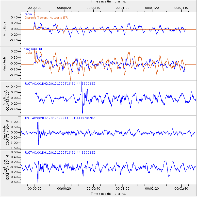
CTAO Charters Towers, Australia - Earthquake Result Viewer
*The percent match for this event was below the threshold and hence no stack was calculated.
| Earthquake location: |
Myanmar |
| Earthquake latitude/longitude: |
22.4/94.8 |
| Earthquake time(UTC): |
2012/12/22 (357) 16:41:45 GMT |
| Earthquake Depth: |
134 km |
| Earthquake Magnitude: |
5.5 MW, 5.4 MB, 5.5 MW |
| Earthquake Catalog/Contributor: |
WHDF/NEIC |
|
| Network: |
IU Global Seismograph Network (GSN - IRIS/USGS) |
| Station: |
CTAO Charters Towers, Australia |
| Lat/Lon: |
20.09 S/146.25 E |
| Elevation: |
357 m |
|
| Distance: |
65.7 deg |
| Az: |
126.198 deg |
| Baz: |
307.408 deg |
| Ray Param: |
$rayparam |
*The percent match for this event was below the threshold and hence was not used in the summary stack. |
|
| Radial Match: |
57.433643 % |
| Radial Bump: |
400 |
| Transverse Match: |
56.684605 % |
| Transverse Bump: |
400 |
| SOD ConfigId: |
558545 |
| Insert Time: |
2013-09-18 02:44:27.450 +0000 |
| GWidth: |
2.5 |
| Max Bumps: |
400 |
| Tol: |
0.001 |
|
Signal To Noise
| Channel | StoN | STA | LTA |
| IU:CTAO:00:BHZ:20121222T16:51:44.869028Z | 3.4839728 | 4.807276E-7 | 1.3798258E-7 |
| IU:CTAO:00:BH1:20121222T16:51:44.869028Z | 2.2890534 | 2.017335E-7 | 8.812966E-8 |
| IU:CTAO:00:BH2:20121222T16:51:44.869028Z | 2.6949012 | 2.2437973E-7 | 8.326084E-8 |
| Arrivals |
| Ps | |
| PpPs | |
| PsPs/PpSs | |


