You are here: Home > Network List > IU - Global Seismograph Network (GSN - IRIS/USGS) Stations List
> Station HNR Honiara, Solomon Islands > Earthquake Result Viewer
HNR Honiara, Solomon Islands - Earthquake Result Viewer
*The percent match for this event was below the threshold and hence no stack was calculated.
| Earthquake location: |
Myanmar |
| Earthquake latitude/longitude: |
22.4/94.8 |
| Earthquake time(UTC): |
2012/12/22 (357) 16:41:45 GMT |
| Earthquake Depth: |
134 km |
| Earthquake Magnitude: |
5.5 MW, 5.4 MB, 5.5 MW |
| Earthquake Catalog/Contributor: |
WHDF/NEIC |
|
| Network: |
IU Global Seismograph Network (GSN - IRIS/USGS) |
| Station: |
HNR Honiara, Solomon Islands |
| Lat/Lon: |
9.44 S/159.95 E |
| Elevation: |
100 m |
|
| Distance: |
71.2 deg |
| Az: |
108.984 deg |
| Baz: |
297.54 deg |
| Ray Param: |
$rayparam |
*The percent match for this event was below the threshold and hence was not used in the summary stack. |
|
| Radial Match: |
64.44004 % |
| Radial Bump: |
400 |
| Transverse Match: |
64.97714 % |
| Transverse Bump: |
400 |
| SOD ConfigId: |
558545 |
| Insert Time: |
2013-09-18 02:44:40.535 +0000 |
| GWidth: |
2.5 |
| Max Bumps: |
400 |
| Tol: |
0.001 |
|
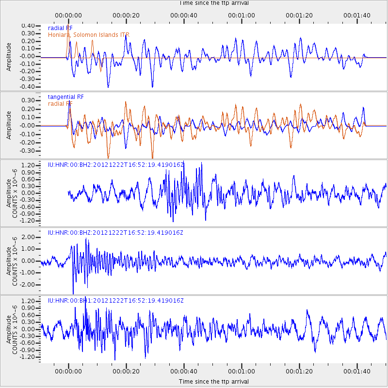
Signal To Noise
| Channel | StoN | STA | LTA |
| IU:HNR:00:BHZ:20121222T16:52:19.419016Z | 3.981076 | 8.692213E-7 | 2.1833829E-7 |
| IU:HNR:00:BH1:20121222T16:52:19.419016Z | 2.0533354 | 3.3901497E-7 | 1.6510454E-7 |
| IU:HNR:00:BH2:20121222T16:52:19.419016Z | 1.9838824 | 4.2798854E-7 | 2.1573283E-7 |
| Arrivals |
| Ps | |
| PpPs | |
| PsPs/PpSs | |


