You are here: Home > Network List > IU - Global Seismograph Network (GSN - IRIS/USGS) Stations List
> Station PMG Port Moresby, New Guinea > Earthquake Result Viewer
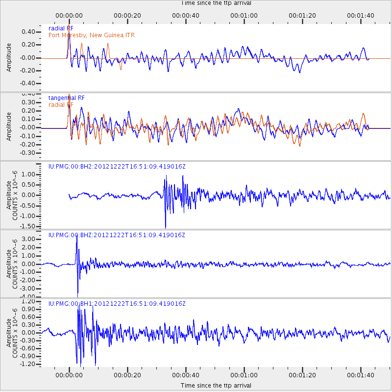
PMG Port Moresby, New Guinea - Earthquake Result Viewer
*The percent match for this event was below the threshold and hence no stack was calculated.
| Earthquake location: |
Myanmar |
| Earthquake latitude/longitude: |
22.4/94.8 |
| Earthquake time(UTC): |
2012/12/22 (357) 16:41:45 GMT |
| Earthquake Depth: |
134 km |
| Earthquake Magnitude: |
5.5 MW, 5.4 MB, 5.5 MW |
| Earthquake Catalog/Contributor: |
WHDF/NEIC |
|
| Network: |
IU Global Seismograph Network (GSN - IRIS/USGS) |
| Station: |
PMG Port Moresby, New Guinea |
| Lat/Lon: |
9.40 S/147.16 E |
| Elevation: |
90 m |
|
| Distance: |
60.3 deg |
| Az: |
115.861 deg |
| Baz: |
302.467 deg |
| Ray Param: |
$rayparam |
*The percent match for this event was below the threshold and hence was not used in the summary stack. |
|
| Radial Match: |
63.70082 % |
| Radial Bump: |
400 |
| Transverse Match: |
62.224243 % |
| Transverse Bump: |
400 |
| SOD ConfigId: |
558545 |
| Insert Time: |
2013-09-18 02:45:13.445 +0000 |
| GWidth: |
2.5 |
| Max Bumps: |
400 |
| Tol: |
0.001 |
|
Signal To Noise
| Channel | StoN | STA | LTA |
| IU:PMG:00:BHZ:20121222T16:51:09.419016Z | 6.9033127 | 1.1251598E-6 | 1.6298837E-7 |
| IU:PMG:00:BH1:20121222T16:51:09.419016Z | 3.6619232 | 4.840346E-7 | 1.3218043E-7 |
| IU:PMG:00:BH2:20121222T16:51:09.419016Z | 6.0380526 | 4.2785484E-7 | 7.085974E-8 |
| Arrivals |
| Ps | |
| PpPs | |
| PsPs/PpSs | |


