You are here: Home > Network List > US - United States National Seismic Network Stations List
> Station CBKS Cedar Bluff, Kansas, USA > Earthquake Result Viewer
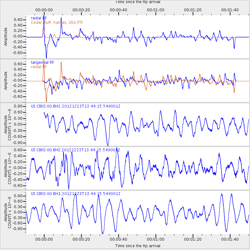
CBKS Cedar Bluff, Kansas, USA - Earthquake Result Viewer
*The percent match for this event was below the threshold and hence no stack was calculated.
| Earthquake location: |
Northwestern Caucasus |
| Earthquake latitude/longitude: |
42.4/41.1 |
| Earthquake time(UTC): |
2012/12/23 (358) 13:31:40 GMT |
| Earthquake Depth: |
15 km |
| Earthquake Magnitude: |
5.5 MB, 5.6 MS, 5.7 MW, 5.6 MW |
| Earthquake Catalog/Contributor: |
WHDF/NEIC |
|
| Network: |
US United States National Seismic Network |
| Station: |
CBKS Cedar Bluff, Kansas, USA |
| Lat/Lon: |
38.81 N/99.74 W |
| Elevation: |
677 m |
|
| Distance: |
91.7 deg |
| Az: |
330.407 deg |
| Baz: |
27.909 deg |
| Ray Param: |
$rayparam |
*The percent match for this event was below the threshold and hence was not used in the summary stack. |
|
| Radial Match: |
64.23706 % |
| Radial Bump: |
400 |
| Transverse Match: |
47.127434 % |
| Transverse Bump: |
400 |
| SOD ConfigId: |
558545 |
| Insert Time: |
2013-09-18 02:48:02.314 +0000 |
| GWidth: |
2.5 |
| Max Bumps: |
400 |
| Tol: |
0.001 |
|
Signal To Noise
| Channel | StoN | STA | LTA |
| US:CBKS:00:BHZ:20121223T13:44:15.549001Z | 0.8637007 | 2.1578384E-7 | 2.4983635E-7 |
| US:CBKS:00:BH1:20121223T13:44:15.549001Z | 0.8791565 | 3.257581E-7 | 3.7053485E-7 |
| US:CBKS:00:BH2:20121223T13:44:15.549001Z | 2.0817673 | 5.3702695E-7 | 2.5796686E-7 |
| Arrivals |
| Ps | |
| PpPs | |
| PsPs/PpSs | |


