You are here: Home > Network List > US - United States National Seismic Network Stations List
> Station DGMT Dagmar, Montana, USA > Earthquake Result Viewer
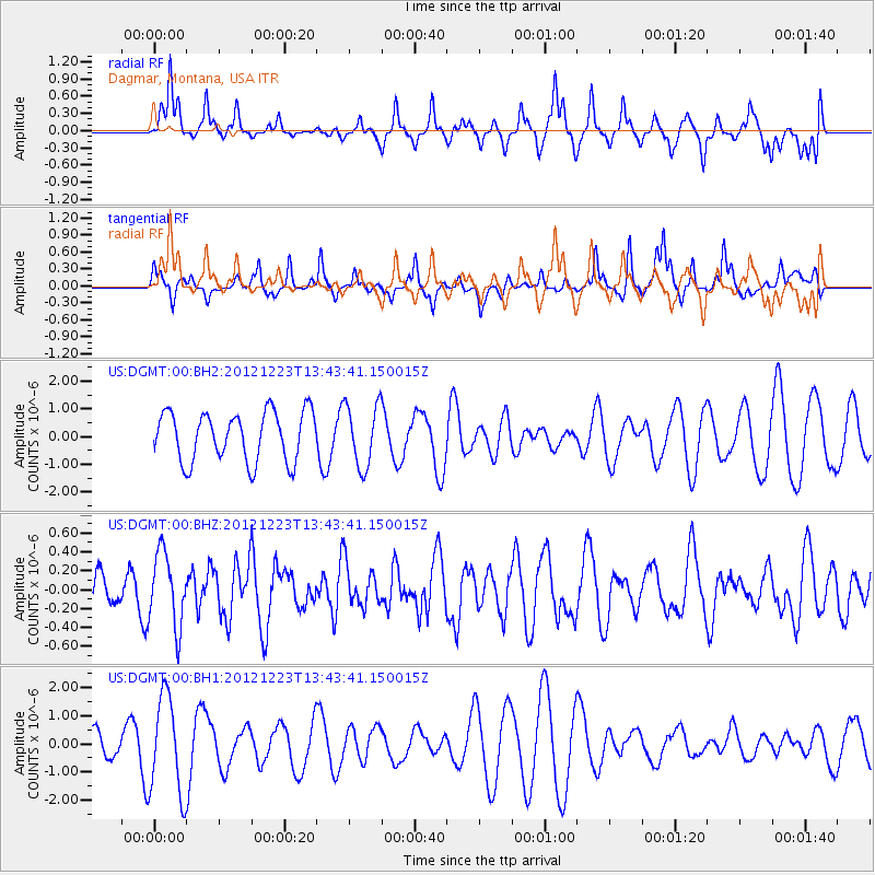
DGMT Dagmar, Montana, USA - Earthquake Result Viewer
*The percent match for this event was below the threshold and hence no stack was calculated.
| Earthquake location: |
Northwestern Caucasus |
| Earthquake latitude/longitude: |
42.4/41.1 |
| Earthquake time(UTC): |
2012/12/23 (358) 13:31:40 GMT |
| Earthquake Depth: |
15 km |
| Earthquake Magnitude: |
5.5 MB, 5.6 MS, 5.7 MW, 5.6 MW |
| Earthquake Catalog/Contributor: |
WHDF/NEIC |
|
| Network: |
US United States National Seismic Network |
| Station: |
DGMT Dagmar, Montana, USA |
| Lat/Lon: |
48.47 N/104.20 W |
| Elevation: |
0.0 m |
|
| Distance: |
84.5 deg |
| Az: |
337.609 deg |
| Baz: |
25.077 deg |
| Ray Param: |
$rayparam |
*The percent match for this event was below the threshold and hence was not used in the summary stack. |
|
| Radial Match: |
59.512146 % |
| Radial Bump: |
336 |
| Transverse Match: |
33.272038 % |
| Transverse Bump: |
277 |
| SOD ConfigId: |
558545 |
| Insert Time: |
2013-09-18 02:48:13.887 +0000 |
| GWidth: |
2.5 |
| Max Bumps: |
400 |
| Tol: |
0.001 |
|
Signal To Noise
| Channel | StoN | STA | LTA |
| US:DGMT:00:BHZ:20121223T13:43:41.150015Z | 1.7458937 | 3.8931745E-7 | 2.2299037E-7 |
| US:DGMT:00:BH1:20121223T13:43:41.150015Z | 1.8991239 | 1.7338174E-6 | 9.1295647E-7 |
| US:DGMT:00:BH2:20121223T13:43:41.150015Z | 1.263176 | 1.1274694E-6 | 8.9256724E-7 |
| Arrivals |
| Ps | |
| PpPs | |
| PsPs/PpSs | |


