You are here: Home > Network List > IU - Global Seismograph Network (GSN - IRIS/USGS) Stations List
> Station TEIG Tepich, Yucatan, Mexico > Earthquake Result Viewer
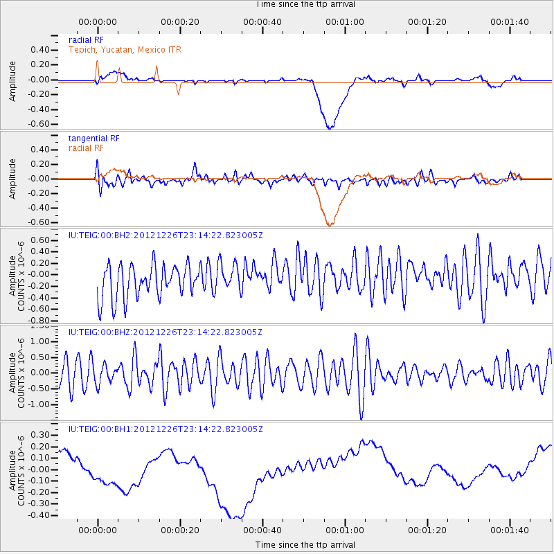
TEIG Tepich, Yucatan, Mexico - Earthquake Result Viewer
*The percent match for this event was below the threshold and hence no stack was calculated.
| Earthquake location: |
Pacific-Antarctic Ridge |
| Earthquake latitude/longitude: |
-56.2/-144.5 |
| Earthquake time(UTC): |
2012/12/26 (361) 23:01:56 GMT |
| Earthquake Depth: |
10 km |
| Earthquake Magnitude: |
5.5 MB, 5.2 MS, 5.5 MW, 5.5 MW |
| Earthquake Catalog/Contributor: |
WHDF/NEIC |
|
| Network: |
IU Global Seismograph Network (GSN - IRIS/USGS) |
| Station: |
TEIG Tepich, Yucatan, Mexico |
| Lat/Lon: |
20.23 N/88.28 W |
| Elevation: |
40 m |
|
| Distance: |
89.6 deg |
| Az: |
51.301 deg |
| Baz: |
207.687 deg |
| Ray Param: |
$rayparam |
*The percent match for this event was below the threshold and hence was not used in the summary stack. |
|
| Radial Match: |
16.796923 % |
| Radial Bump: |
400 |
| Transverse Match: |
47.82442 % |
| Transverse Bump: |
400 |
| SOD ConfigId: |
558545 |
| Insert Time: |
2013-09-18 02:55:30.176 +0000 |
| GWidth: |
2.5 |
| Max Bumps: |
400 |
| Tol: |
0.001 |
|
Signal To Noise
| Channel | StoN | STA | LTA |
| IU:TEIG:00:BHZ:20121226T23:14:22.823005Z | 0.7265245 | 2.7727663E-7 | 3.8164802E-7 |
| IU:TEIG:00:BH1:20121226T23:14:22.823005Z | 1.2326388 | 4.3033856E-7 | 3.4911974E-7 |
| IU:TEIG:00:BH2:20121226T23:14:22.823005Z | 0.88307613 | 2.4976316E-7 | 2.828331E-7 |
| Arrivals |
| Ps | |
| PpPs | |
| PsPs/PpSs | |


