You are here: Home > Network List > II - Global Seismograph Network (GSN - IRIS/IDA) Stations List
> Station WRAB Tennant Creek, NT, Australia > Earthquake Result Viewer
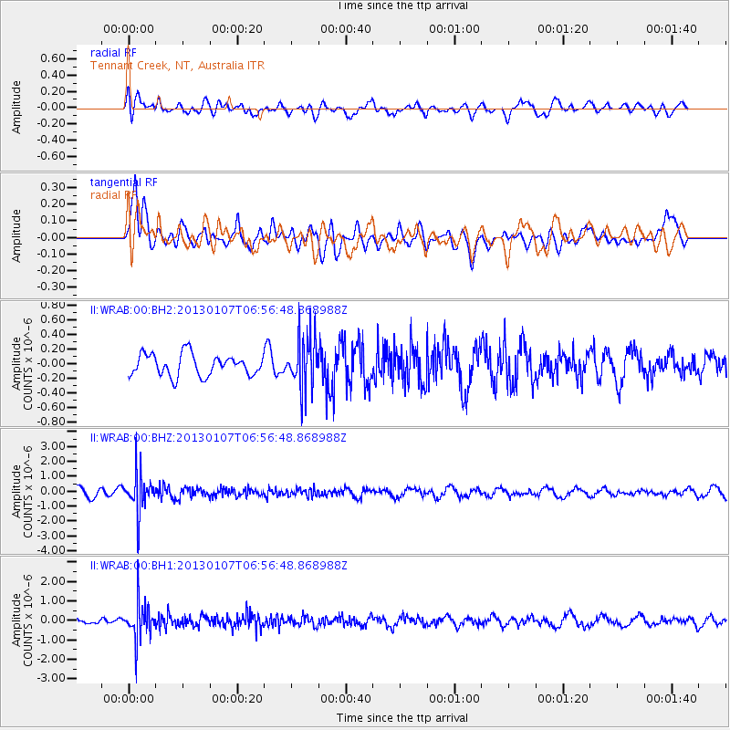
WRAB Tennant Creek, NT, Australia - Earthquake Result Viewer
*The percent match for this event was below the threshold and hence no stack was calculated.
| Earthquake location: |
Taiwan Region |
| Earthquake latitude/longitude: |
24.6/122.9 |
| Earthquake time(UTC): |
2013/01/07 (007) 06:49:06 GMT |
| Earthquake Depth: |
78 km |
| Earthquake Magnitude: |
5.6 ML |
| Earthquake Catalog/Contributor: |
NEIC PDE/NEIC PDE-W |
|
| Network: |
II Global Seismograph Network (GSN - IRIS/IDA) |
| Station: |
WRAB Tennant Creek, NT, Australia |
| Lat/Lon: |
19.93 S/134.36 E |
| Elevation: |
366 m |
|
| Distance: |
45.6 deg |
| Az: |
164.793 deg |
| Baz: |
345.294 deg |
| Ray Param: |
$rayparam |
*The percent match for this event was below the threshold and hence was not used in the summary stack. |
|
| Radial Match: |
63.048485 % |
| Radial Bump: |
400 |
| Transverse Match: |
64.249756 % |
| Transverse Bump: |
400 |
| SOD ConfigId: |
558545 |
| Insert Time: |
2013-09-18 03:34:37.934 +0000 |
| GWidth: |
2.5 |
| Max Bumps: |
400 |
| Tol: |
0.001 |
|
Signal To Noise
| Channel | StoN | STA | LTA |
| II:WRAB:00:BHZ:20130107T06:56:48.868988Z | 4.8584867 | 1.2896963E-6 | 2.6545226E-7 |
| II:WRAB:00:BH1:20130107T06:56:48.868988Z | 5.3712754 | 9.1228713E-7 | 1.6984553E-7 |
| II:WRAB:00:BH2:20130107T06:56:48.868988Z | 2.4288466 | 3.5694842E-7 | 1.4696211E-7 |
| Arrivals |
| Ps | |
| PpPs | |
| PsPs/PpSs | |


