You are here: Home > Network List > II - Global Seismograph Network (GSN - IRIS/IDA) Stations List
> Station WRAB Tennant Creek, NT, Australia > Earthquake Result Viewer
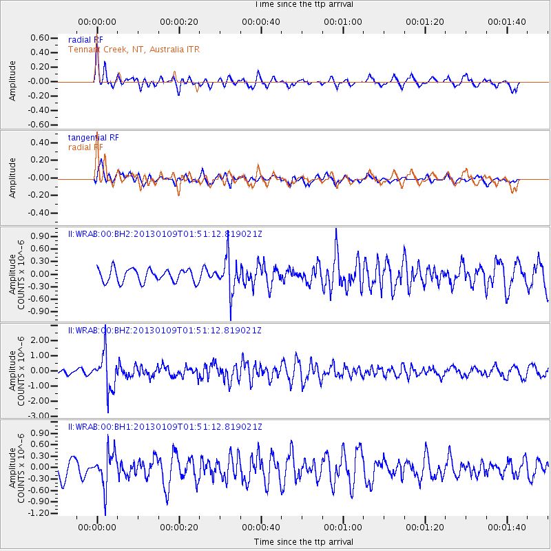
WRAB Tennant Creek, NT, Australia - Earthquake Result Viewer
*The percent match for this event was below the threshold and hence no stack was calculated.
| Earthquake location: |
Myanmar-India Border Region |
| Earthquake latitude/longitude: |
25.3/95.0 |
| Earthquake time(UTC): |
2013/01/09 (009) 01:41:53 GMT |
| Earthquake Depth: |
93 km |
| Earthquake Magnitude: |
5.8 MB, 5.8 MW, 5.8 MW |
| Earthquake Catalog/Contributor: |
WHDF/NEIC |
|
| Network: |
II Global Seismograph Network (GSN - IRIS/IDA) |
| Station: |
WRAB Tennant Creek, NT, Australia |
| Lat/Lon: |
19.93 S/134.36 E |
| Elevation: |
366 m |
|
| Distance: |
59.0 deg |
| Az: |
135.962 deg |
| Baz: |
318.037 deg |
| Ray Param: |
$rayparam |
*The percent match for this event was below the threshold and hence was not used in the summary stack. |
|
| Radial Match: |
68.99783 % |
| Radial Bump: |
352 |
| Transverse Match: |
45.69413 % |
| Transverse Bump: |
392 |
| SOD ConfigId: |
558545 |
| Insert Time: |
2013-09-18 03:50:26.710 +0000 |
| GWidth: |
2.5 |
| Max Bumps: |
400 |
| Tol: |
0.001 |
|
Signal To Noise
| Channel | StoN | STA | LTA |
| II:WRAB:00:BHZ:20130109T01:51:12.819021Z | 7.4137588 | 1.1961985E-6 | 1.6134845E-7 |
| II:WRAB:00:BH1:20130109T01:51:12.819021Z | 1.4702982 | 4.4919588E-7 | 3.0551348E-7 |
| II:WRAB:00:BH2:20130109T01:51:12.819021Z | 2.6727765 | 4.143547E-7 | 1.5502782E-7 |
| Arrivals |
| Ps | |
| PpPs | |
| PsPs/PpSs | |


