You are here: Home > Network List > IU - Global Seismograph Network (GSN - IRIS/USGS) Stations List
> Station TEIG Tepich, Yucatan, Mexico > Earthquake Result Viewer
TEIG Tepich, Yucatan, Mexico - Earthquake Result Viewer
*The percent match for this event was below the threshold and hence no stack was calculated.
| Earthquake location: |
Pacific-Antarctic Ridge |
| Earthquake latitude/longitude: |
-57.0/-141.5 |
| Earthquake time(UTC): |
2013/01/09 (009) 21:46:02 GMT |
| Earthquake Depth: |
10 km |
| Earthquake Magnitude: |
5.6 MW, 5.0 MS, 5.3 MB, 5.5 MW |
| Earthquake Catalog/Contributor: |
WHDF/NEIC |
|
| Network: |
IU Global Seismograph Network (GSN - IRIS/USGS) |
| Station: |
TEIG Tepich, Yucatan, Mexico |
| Lat/Lon: |
20.23 N/88.28 W |
| Elevation: |
40 m |
|
| Distance: |
88.9 deg |
| Az: |
48.763 deg |
| Baz: |
205.951 deg |
| Ray Param: |
$rayparam |
*The percent match for this event was below the threshold and hence was not used in the summary stack. |
|
| Radial Match: |
37.801125 % |
| Radial Bump: |
400 |
| Transverse Match: |
38.770794 % |
| Transverse Bump: |
400 |
| SOD ConfigId: |
558545 |
| Insert Time: |
2013-09-18 03:54:50.052 +0000 |
| GWidth: |
2.5 |
| Max Bumps: |
400 |
| Tol: |
0.001 |
|
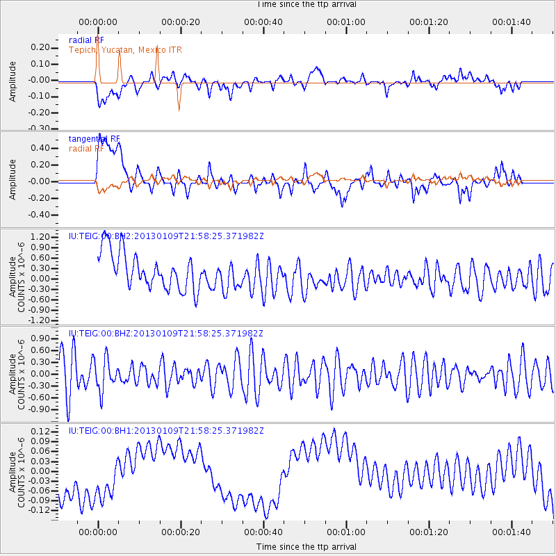
Signal To Noise
| Channel | StoN | STA | LTA |
| IU:TEIG:00:BHZ:20130109T21:58:25.371982Z | 0.99160606 | 3.964956E-7 | 3.9985196E-7 |
| IU:TEIG:00:BH1:20130109T21:58:25.371982Z | 0.79579455 | 8.2752784E-8 | 1.03987624E-7 |
| IU:TEIG:00:BH2:20130109T21:58:25.371982Z | 0.8333571 | 4.4212294E-7 | 5.3053236E-7 |
| Arrivals |
| Ps | |
| PpPs | |
| PsPs/PpSs | |


