You are here: Home > Network List > US - United States National Seismic Network Stations List
> Station WMOK Wichita Mountains, Oklahoma, USA > Earthquake Result Viewer
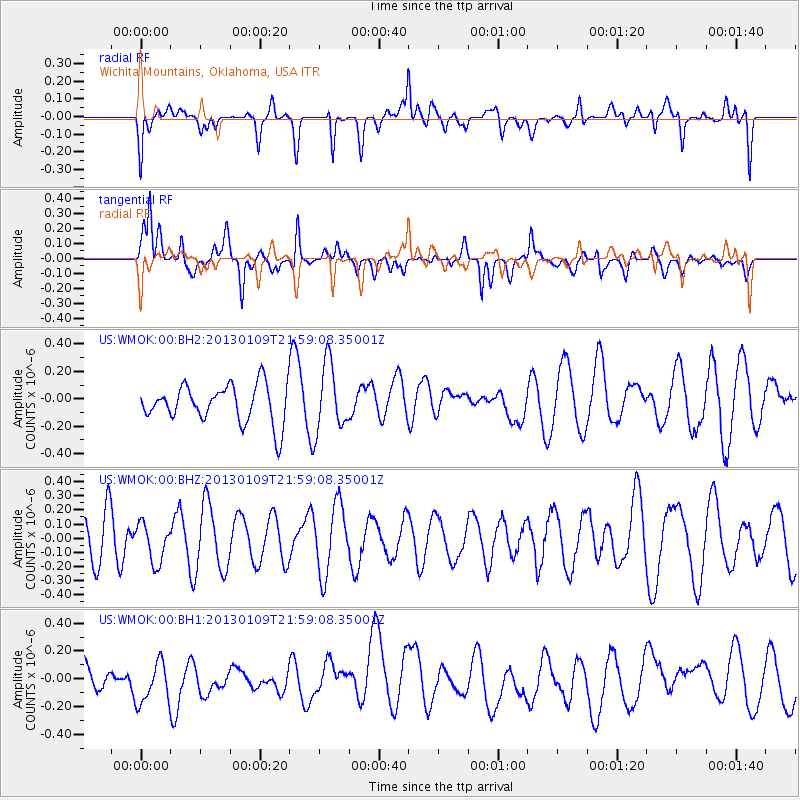
WMOK Wichita Mountains, Oklahoma, USA - Earthquake Result Viewer
*The percent match for this event was below the threshold and hence no stack was calculated.
| Earthquake location: |
Pacific-Antarctic Ridge |
| Earthquake latitude/longitude: |
-57.0/-141.5 |
| Earthquake time(UTC): |
2013/01/09 (009) 21:46:02 GMT |
| Earthquake Depth: |
10 km |
| Earthquake Magnitude: |
5.6 MW, 5.0 MS, 5.3 MB, 5.5 MW |
| Earthquake Catalog/Contributor: |
WHDF/NEIC |
|
| Network: |
US United States National Seismic Network |
| Station: |
WMOK Wichita Mountains, Oklahoma, USA |
| Lat/Lon: |
34.74 N/98.78 W |
| Elevation: |
486 m |
|
| Distance: |
98.3 deg |
| Az: |
34.349 deg |
| Baz: |
201.987 deg |
| Ray Param: |
$rayparam |
*The percent match for this event was below the threshold and hence was not used in the summary stack. |
|
| Radial Match: |
48.919632 % |
| Radial Bump: |
400 |
| Transverse Match: |
60.5485 % |
| Transverse Bump: |
400 |
| SOD ConfigId: |
558545 |
| Insert Time: |
2013-09-18 03:55:32.413 +0000 |
| GWidth: |
2.5 |
| Max Bumps: |
400 |
| Tol: |
0.001 |
|
Signal To Noise
| Channel | StoN | STA | LTA |
| US:WMOK:00:BHZ:20130109T21:59:08.35001Z | 0.91949326 | 1.3921729E-7 | 1.5140654E-7 |
| US:WMOK:00:BH1:20130109T21:59:08.35001Z | 1.0084202 | 1.5745375E-7 | 1.5613902E-7 |
| US:WMOK:00:BH2:20130109T21:59:08.35001Z | 1.8050514 | 2.4749733E-7 | 1.3711372E-7 |
| Arrivals |
| Ps | |
| PpPs | |
| PsPs/PpSs | |


