You are here: Home > Network List > IU - Global Seismograph Network (GSN - IRIS/USGS) Stations List
> Station CTAO Charters Towers, Australia > Earthquake Result Viewer
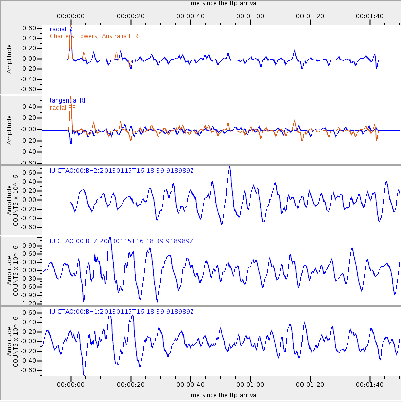
CTAO Charters Towers, Australia - Earthquake Result Viewer
*The percent match for this event was below the threshold and hence no stack was calculated.
| Earthquake location: |
Pacific-Antarctic Ridge |
| Earthquake latitude/longitude: |
-62.6/-161.4 |
| Earthquake time(UTC): |
2013/01/15 (015) 16:09:37 GMT |
| Earthquake Depth: |
10 km |
| Earthquake Magnitude: |
5.5 MB, 5.9 MS, 6.1 MW, 6.1 MW |
| Earthquake Catalog/Contributor: |
WHDF/NEIC |
|
| Network: |
IU Global Seismograph Network (GSN - IRIS/USGS) |
| Station: |
CTAO Charters Towers, Australia |
| Lat/Lon: |
20.09 S/146.25 E |
| Elevation: |
357 m |
|
| Distance: |
55.3 deg |
| Az: |
295.273 deg |
| Baz: |
153.542 deg |
| Ray Param: |
$rayparam |
*The percent match for this event was below the threshold and hence was not used in the summary stack. |
|
| Radial Match: |
74.21197 % |
| Radial Bump: |
340 |
| Transverse Match: |
57.771835 % |
| Transverse Bump: |
400 |
| SOD ConfigId: |
558545 |
| Insert Time: |
2013-09-18 04:19:53.543 +0000 |
| GWidth: |
2.5 |
| Max Bumps: |
400 |
| Tol: |
0.001 |
|
Signal To Noise
| Channel | StoN | STA | LTA |
| IU:CTAO:00:BHZ:20130115T16:18:39.918989Z | 1.8499066 | 4.2757583E-7 | 2.3113374E-7 |
| IU:CTAO:00:BH1:20130115T16:18:39.918989Z | 1.9650813 | 2.9784292E-7 | 1.5156773E-7 |
| IU:CTAO:00:BH2:20130115T16:18:39.918989Z | 2.096885 | 2.4198948E-7 | 1.1540427E-7 |
| Arrivals |
| Ps | |
| PpPs | |
| PsPs/PpSs | |


