You are here: Home > Network List > US - United States National Seismic Network Stations List
> Station BOZ Bozeman, Montana, USA > Earthquake Result Viewer
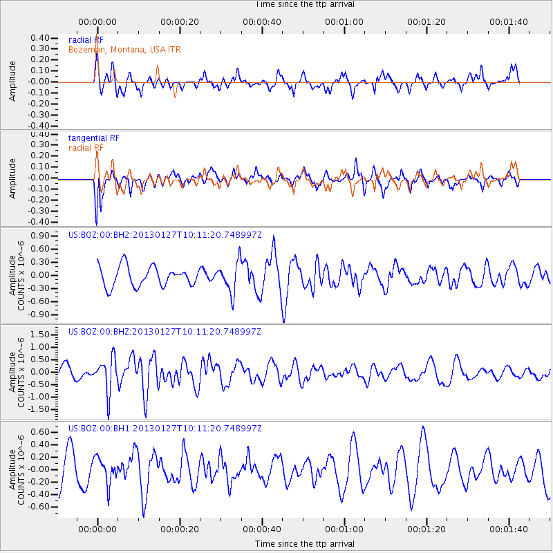
BOZ Bozeman, Montana, USA - Earthquake Result Viewer
*The percent match for this event was below the threshold and hence no stack was calculated.
| Earthquake location: |
Tonga Islands |
| Earthquake latitude/longitude: |
-16.1/-173.2 |
| Earthquake time(UTC): |
2013/01/27 (027) 09:59:29 GMT |
| Earthquake Depth: |
19 km |
| Earthquake Magnitude: |
5.7 MB, 5.5 MS, 5.7 MW, 5.7 MW |
| Earthquake Catalog/Contributor: |
WHDF/NEIC |
|
| Network: |
US United States National Seismic Network |
| Station: |
BOZ Bozeman, Montana, USA |
| Lat/Lon: |
45.65 N/111.63 W |
| Elevation: |
1589 m |
|
| Distance: |
82.9 deg |
| Az: |
38.454 deg |
| Baz: |
238.444 deg |
| Ray Param: |
$rayparam |
*The percent match for this event was below the threshold and hence was not used in the summary stack. |
|
| Radial Match: |
67.304245 % |
| Radial Bump: |
400 |
| Transverse Match: |
61.408016 % |
| Transverse Bump: |
376 |
| SOD ConfigId: |
558545 |
| Insert Time: |
2013-09-18 04:51:22.454 +0000 |
| GWidth: |
2.5 |
| Max Bumps: |
400 |
| Tol: |
0.001 |
|
Signal To Noise
| Channel | StoN | STA | LTA |
| US:BOZ:00:BHZ:20130127T10:11:20.748997Z | 2.1217759 | 6.9346123E-7 | 3.268306E-7 |
| US:BOZ:00:BH1:20130127T10:11:20.748997Z | 1.0155377 | 2.0869317E-7 | 2.0550016E-7 |
| US:BOZ:00:BH2:20130127T10:11:20.748997Z | 1.6340439 | 3.6669528E-7 | 2.2440967E-7 |
| Arrivals |
| Ps | |
| PpPs | |
| PsPs/PpSs | |


