You are here: Home > Network List > US - United States National Seismic Network Stations List
> Station HAWA Hanford, Washington, USA > Earthquake Result Viewer
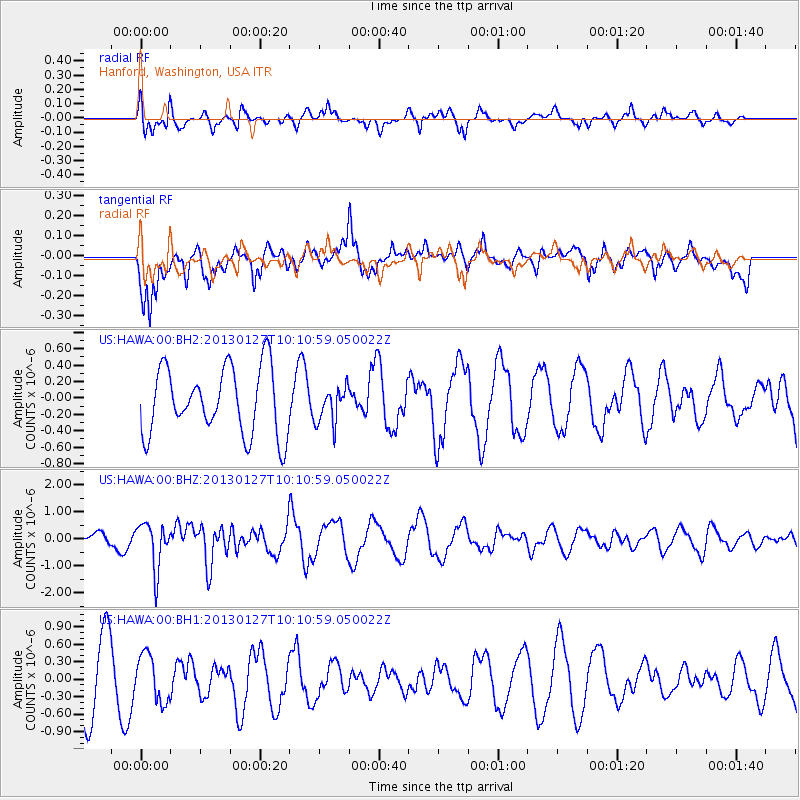
HAWA Hanford, Washington, USA - Earthquake Result Viewer
*The percent match for this event was below the threshold and hence no stack was calculated.
| Earthquake location: |
Tonga Islands |
| Earthquake latitude/longitude: |
-16.1/-173.2 |
| Earthquake time(UTC): |
2013/01/27 (027) 09:59:29 GMT |
| Earthquake Depth: |
19 km |
| Earthquake Magnitude: |
5.7 MB, 5.5 MS, 5.7 MW, 5.7 MW |
| Earthquake Catalog/Contributor: |
WHDF/NEIC |
|
| Network: |
US United States National Seismic Network |
| Station: |
HAWA Hanford, Washington, USA |
| Lat/Lon: |
46.39 N/119.53 W |
| Elevation: |
364 m |
|
| Distance: |
78.8 deg |
| Az: |
34.661 deg |
| Baz: |
232.166 deg |
| Ray Param: |
$rayparam |
*The percent match for this event was below the threshold and hence was not used in the summary stack. |
|
| Radial Match: |
66.18805 % |
| Radial Bump: |
400 |
| Transverse Match: |
58.795723 % |
| Transverse Bump: |
400 |
| SOD ConfigId: |
558545 |
| Insert Time: |
2013-09-18 04:51:58.362 +0000 |
| GWidth: |
2.5 |
| Max Bumps: |
400 |
| Tol: |
0.001 |
|
Signal To Noise
| Channel | StoN | STA | LTA |
| US:HAWA:00:BHZ:20130127T10:10:59.050022Z | 1.5893804 | 8.462997E-7 | 5.3247146E-7 |
| US:HAWA:00:BH1:20130127T10:10:59.050022Z | 0.89833987 | 4.0344327E-7 | 4.490987E-7 |
| US:HAWA:00:BH2:20130127T10:10:59.050022Z | 0.5422129 | 2.194748E-7 | 4.0477607E-7 |
| Arrivals |
| Ps | |
| PpPs | |
| PsPs/PpSs | |


