You are here: Home > Network List > US - United States National Seismic Network Stations List
> Station EGMT Eagleton, Montana, USA > Earthquake Result Viewer
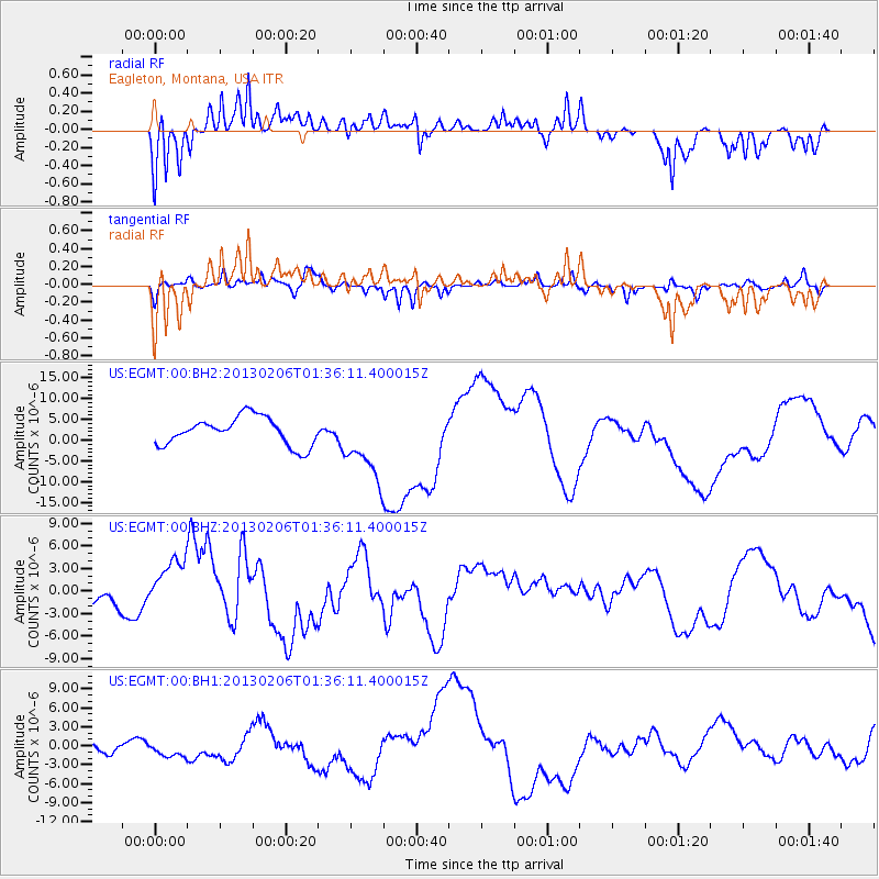
EGMT Eagleton, Montana, USA - Earthquake Result Viewer
*The percent match for this event was below the threshold and hence no stack was calculated.
| Earthquake location: |
Santa Cruz Islands Region |
| Earthquake latitude/longitude: |
-11.2/164.9 |
| Earthquake time(UTC): |
2013/02/06 (037) 01:23:19 GMT |
| Earthquake Depth: |
10 km |
| Earthquake Magnitude: |
6.6 MB, 7.1 MW, 7.1 MW |
| Earthquake Catalog/Contributor: |
WHDF/NEIC |
|
| Network: |
US United States National Seismic Network |
| Station: |
EGMT Eagleton, Montana, USA |
| Lat/Lon: |
48.02 N/109.75 W |
| Elevation: |
1055 m |
|
| Distance: |
95.1 deg |
| Az: |
42.206 deg |
| Baz: |
259.111 deg |
| Ray Param: |
$rayparam |
*The percent match for this event was below the threshold and hence was not used in the summary stack. |
|
| Radial Match: |
81.8107 % |
| Radial Bump: |
385 |
| Transverse Match: |
67.05895 % |
| Transverse Bump: |
310 |
| SOD ConfigId: |
558545 |
| Insert Time: |
2013-09-18 05:13:40.219 +0000 |
| GWidth: |
2.5 |
| Max Bumps: |
400 |
| Tol: |
0.001 |
|
Signal To Noise
| Channel | StoN | STA | LTA |
| US:EGMT:00:BHZ:20130206T01:36:11.400015Z | 2.4953964 | 3.6770439E-6 | 1.4735309E-6 |
| US:EGMT:00:BH1:20130206T01:36:11.400015Z | 1.308797 | 1.379672E-6 | 1.0541528E-6 |
| US:EGMT:00:BH2:20130206T01:36:11.400015Z | 2.5242877 | 8.5308675E-6 | 3.3795145E-6 |
| Arrivals |
| Ps | |
| PpPs | |
| PsPs/PpSs | |


