You are here: Home > Network List > US - United States National Seismic Network Stations List
> Station NEW Newport, Washington, USA > Earthquake Result Viewer
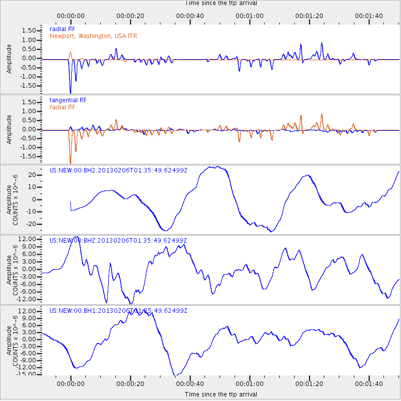
NEW Newport, Washington, USA - Earthquake Result Viewer
*The percent match for this event was below the threshold and hence no stack was calculated.
| Earthquake location: |
Santa Cruz Islands Region |
| Earthquake latitude/longitude: |
-11.2/164.9 |
| Earthquake time(UTC): |
2013/02/06 (037) 01:23:19 GMT |
| Earthquake Depth: |
10 km |
| Earthquake Magnitude: |
6.6 MB, 7.1 MW, 7.1 MW |
| Earthquake Catalog/Contributor: |
WHDF/NEIC |
|
| Network: |
US United States National Seismic Network |
| Station: |
NEW Newport, Washington, USA |
| Lat/Lon: |
48.26 N/117.12 W |
| Elevation: |
760 m |
|
| Distance: |
90.4 deg |
| Az: |
40.814 deg |
| Baz: |
253.706 deg |
| Ray Param: |
$rayparam |
*The percent match for this event was below the threshold and hence was not used in the summary stack. |
|
| Radial Match: |
85.56561 % |
| Radial Bump: |
242 |
| Transverse Match: |
81.02493 % |
| Transverse Bump: |
352 |
| SOD ConfigId: |
558545 |
| Insert Time: |
2013-09-18 05:14:07.257 +0000 |
| GWidth: |
2.5 |
| Max Bumps: |
400 |
| Tol: |
0.001 |
|
Signal To Noise
| Channel | StoN | STA | LTA |
| US:NEW:00:BHZ:20130206T01:35:49.62499Z | 6.135891 | 1.122919E-5 | 1.830083E-6 |
| US:NEW:00:BH1:20130206T01:35:49.62499Z | 5.809076 | 1.1366731E-5 | 1.9567192E-6 |
| US:NEW:00:BH2:20130206T01:35:49.62499Z | 4.526302 | 2.332934E-5 | 5.154172E-6 |
| Arrivals |
| Ps | |
| PpPs | |
| PsPs/PpSs | |


