You are here: Home > Network List > US - United States National Seismic Network Stations List
> Station HAWA Hanford, Washington, USA > Earthquake Result Viewer
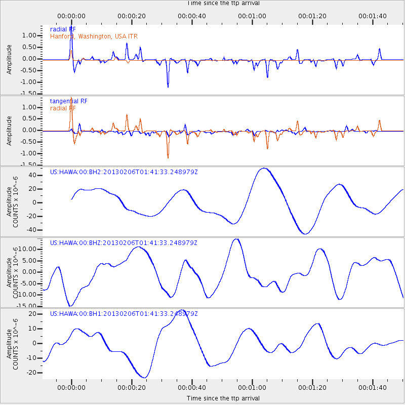
HAWA Hanford, Washington, USA - Earthquake Result Viewer
*The percent match for this event was below the threshold and hence no stack was calculated.
| Earthquake location: |
Santa Cruz Islands Region |
| Earthquake latitude/longitude: |
-10.8/164.6 |
| Earthquake time(UTC): |
2013/02/06 (037) 01:29:13 GMT |
| Earthquake Depth: |
10 km |
| Earthquake Magnitude: |
5.5 MB |
| Earthquake Catalog/Contributor: |
WHDF/NEIC |
|
| Network: |
US United States National Seismic Network |
| Station: |
HAWA Hanford, Washington, USA |
| Lat/Lon: |
46.39 N/119.53 W |
| Elevation: |
364 m |
|
| Distance: |
88.1 deg |
| Az: |
42.18 deg |
| Baz: |
252.415 deg |
| Ray Param: |
$rayparam |
*The percent match for this event was below the threshold and hence was not used in the summary stack. |
|
| Radial Match: |
29.979671 % |
| Radial Bump: |
263 |
| Transverse Match: |
56.15136 % |
| Transverse Bump: |
400 |
| SOD ConfigId: |
558545 |
| Insert Time: |
2013-09-18 05:16:38.834 +0000 |
| GWidth: |
2.5 |
| Max Bumps: |
400 |
| Tol: |
0.001 |
|
Signal To Noise
| Channel | StoN | STA | LTA |
| US:HAWA:00:BHZ:20130206T01:41:33.248979Z | 1.9787455 | 1.1203644E-5 | 5.6619933E-6 |
| US:HAWA:00:BH1:20130206T01:41:33.248979Z | 1.5500135 | 8.884648E-6 | 5.7319808E-6 |
| US:HAWA:00:BH2:20130206T01:41:33.248979Z | 0.85369647 | 1.2054469E-5 | 1.4120323E-5 |
| Arrivals |
| Ps | |
| PpPs | |
| PsPs/PpSs | |


