You are here: Home > Network List > US - United States National Seismic Network Stations List
> Station ELK Elko, Nevada, USA > Earthquake Result Viewer
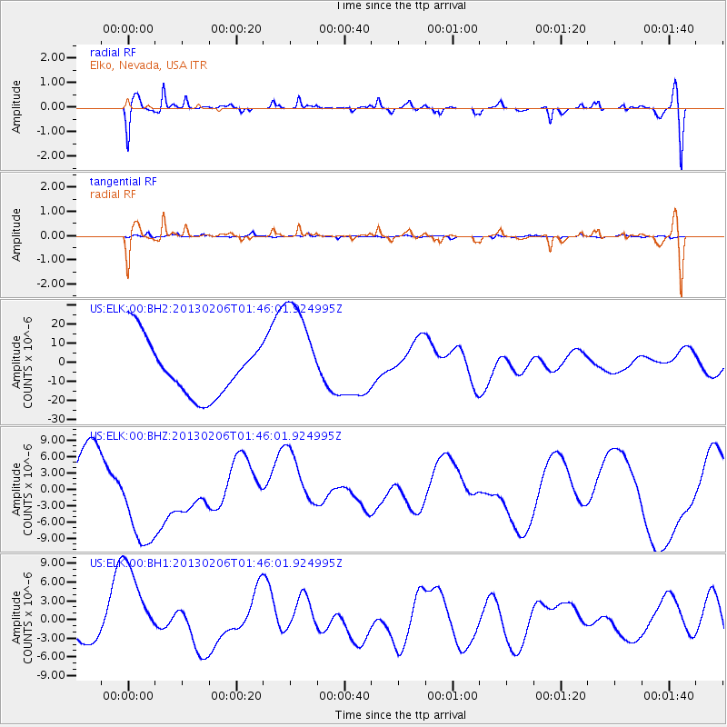
ELK Elko, Nevada, USA - Earthquake Result Viewer
*The percent match for this event was below the threshold and hence no stack was calculated.
| Earthquake location: |
Santa Cruz Islands |
| Earthquake latitude/longitude: |
-11.0/165.2 |
| Earthquake time(UTC): |
2013/02/06 (037) 01:33:37 GMT |
| Earthquake Depth: |
10 km |
| Earthquake Magnitude: |
5.6 MB |
| Earthquake Catalog/Contributor: |
WHDF/NEIC |
|
| Network: |
US United States National Seismic Network |
| Station: |
ELK Elko, Nevada, USA |
| Lat/Lon: |
40.74 N/115.24 W |
| Elevation: |
2210 m |
|
| Distance: |
89.3 deg |
| Az: |
48.352 deg |
| Baz: |
254.959 deg |
| Ray Param: |
$rayparam |
*The percent match for this event was below the threshold and hence was not used in the summary stack. |
|
| Radial Match: |
49.32842 % |
| Radial Bump: |
400 |
| Transverse Match: |
36.57005 % |
| Transverse Bump: |
256 |
| SOD ConfigId: |
558545 |
| Insert Time: |
2013-09-18 05:21:43.211 +0000 |
| GWidth: |
2.5 |
| Max Bumps: |
400 |
| Tol: |
0.001 |
|
Signal To Noise
| Channel | StoN | STA | LTA |
| US:ELK:00:BHZ:20130206T01:46:01.924995Z | 2.9993043 | 9.9663275E-6 | 3.3228796E-6 |
| US:ELK:00:BH1:20130206T01:46:01.924995Z | 2.09105 | 7.388486E-6 | 3.5333858E-6 |
| US:ELK:00:BH2:20130206T01:46:01.924995Z | 1.9470192 | 2.7900038E-5 | 1.4329616E-5 |
| Arrivals |
| Ps | |
| PpPs | |
| PsPs/PpSs | |


