You are here: Home > Network List > US - United States National Seismic Network Stations List
> Station MNTX Cornudas Mountains, Texas, USA > Earthquake Result Viewer
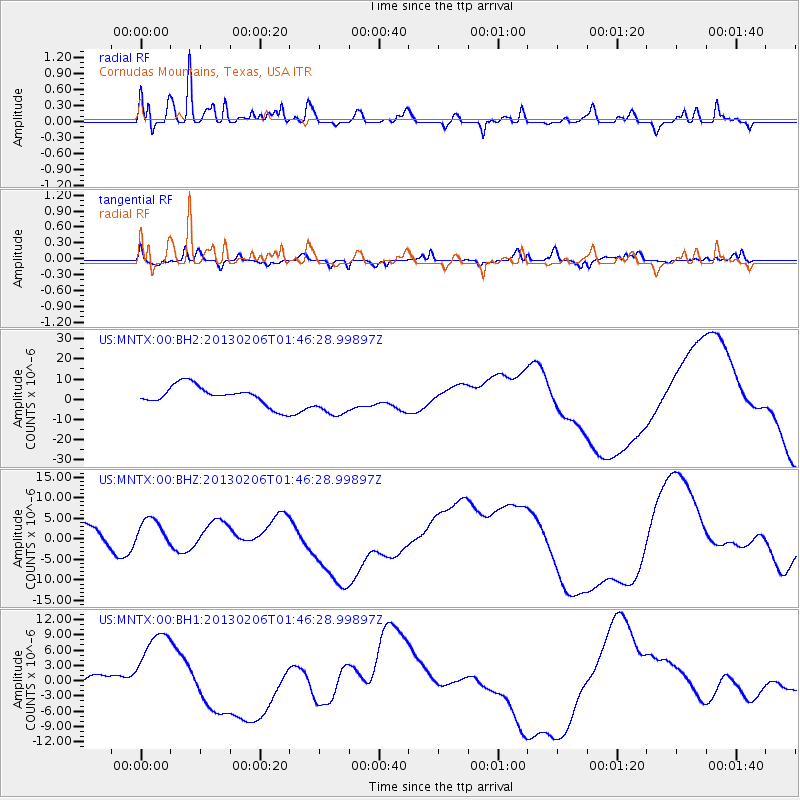
MNTX Cornudas Mountains, Texas, USA - Earthquake Result Viewer
*The percent match for this event was below the threshold and hence no stack was calculated.
| Earthquake location: |
Santa Cruz Islands |
| Earthquake latitude/longitude: |
-11.0/165.2 |
| Earthquake time(UTC): |
2013/02/06 (037) 01:33:37 GMT |
| Earthquake Depth: |
10 km |
| Earthquake Magnitude: |
5.6 MB |
| Earthquake Catalog/Contributor: |
WHDF/NEIC |
|
| Network: |
US United States National Seismic Network |
| Station: |
MNTX Cornudas Mountains, Texas, USA |
| Lat/Lon: |
31.70 N/105.38 W |
| Elevation: |
404 m |
|
| Distance: |
95.2 deg |
| Az: |
58.853 deg |
| Baz: |
260.374 deg |
| Ray Param: |
$rayparam |
*The percent match for this event was below the threshold and hence was not used in the summary stack. |
|
| Radial Match: |
50.855793 % |
| Radial Bump: |
323 |
| Transverse Match: |
50.947956 % |
| Transverse Bump: |
342 |
| SOD ConfigId: |
558545 |
| Insert Time: |
2013-09-18 05:21:57.278 +0000 |
| GWidth: |
2.5 |
| Max Bumps: |
400 |
| Tol: |
0.001 |
|
Signal To Noise
| Channel | StoN | STA | LTA |
| US:MNTX:00:BHZ:20130206T01:46:28.99897Z | 1.2576914 | 4.980826E-6 | 3.9602924E-6 |
| US:MNTX:00:BH1:20130206T01:46:28.99897Z | 1.6776485 | 8.378781E-6 | 4.9943596E-6 |
| US:MNTX:00:BH2:20130206T01:46:28.99897Z | 1.718144 | 8.288904E-6 | 4.8243355E-6 |
| Arrivals |
| Ps | |
| PpPs | |
| PsPs/PpSs | |


