You are here: Home > Network List > TA - USArray Transportable Network (new EarthScope stations) Stations List
> Station V61A Roper, NC, USA > Earthquake Result Viewer
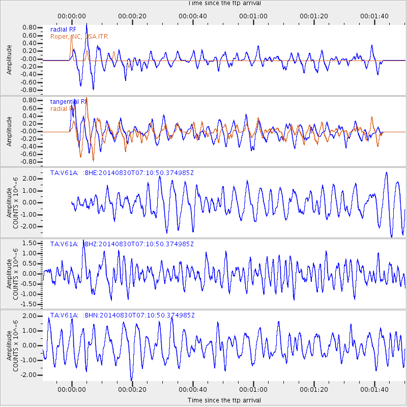
V61A Roper, NC, USA - Earthquake Result Viewer
*The percent match for this event was below the threshold and hence no stack was calculated.
| Earthquake location: |
Iceland |
| Earthquake latitude/longitude: |
64.6/-17.5 |
| Earthquake time(UTC): |
2014/08/30 (242) 07:03:04 GMT |
| Earthquake Depth: |
6.0 km |
| Earthquake Magnitude: |
5.4 Mww, 5.3 mb, 5.0 Ms_20, 5.3 Mwb, 5.4 ML |
| Earthquake Catalog/Contributor: |
ISC/ISC |
|
| Network: |
TA USArray Transportable Network (new EarthScope stations) |
| Station: |
V61A Roper, NC, USA |
| Lat/Lon: |
35.79 N/76.58 W |
| Elevation: |
4.0 m |
|
| Distance: |
45.1 deg |
| Az: |
259.788 deg |
| Baz: |
31.481 deg |
| Ray Param: |
$rayparam |
*The percent match for this event was below the threshold and hence was not used in the summary stack. |
|
| Radial Match: |
59.37125 % |
| Radial Bump: |
393 |
| Transverse Match: |
43.548084 % |
| Transverse Bump: |
400 |
| SOD ConfigId: |
3390531 |
| Insert Time: |
2019-04-13 17:31:11.207 +0000 |
| GWidth: |
2.5 |
| Max Bumps: |
400 |
| Tol: |
0.001 |
|
Signal To Noise
| Channel | StoN | STA | LTA |
| TA:V61A: :BHZ:20140830T07:10:50.374985Z | 1.4824449 | 6.2534536E-7 | 4.2183382E-7 |
| TA:V61A: :BHN:20140830T07:10:50.374985Z | 1.3419397 | 1.0275812E-6 | 7.657432E-7 |
| TA:V61A: :BHE:20140830T07:10:50.374985Z | 2.686265 | 1.4314002E-6 | 5.328589E-7 |
| Arrivals |
| Ps | |
| PpPs | |
| PsPs/PpSs | |


