You are here: Home > Network List > TA - USArray Transportable Network (new EarthScope stations) Stations List
> Station V60A Jim Taylor Road, Stokes, NC, USA > Earthquake Result Viewer
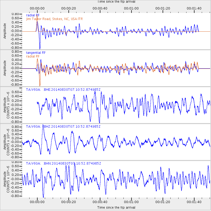
V60A Jim Taylor Road, Stokes, NC, USA - Earthquake Result Viewer
*The percent match for this event was below the threshold and hence no stack was calculated.
| Earthquake location: |
Iceland |
| Earthquake latitude/longitude: |
64.6/-17.5 |
| Earthquake time(UTC): |
2014/08/30 (242) 07:03:04 GMT |
| Earthquake Depth: |
6.0 km |
| Earthquake Magnitude: |
5.4 Mww, 5.3 mb, 5.0 Ms_20, 5.3 Mwb, 5.4 ML |
| Earthquake Catalog/Contributor: |
ISC/ISC |
|
| Network: |
TA USArray Transportable Network (new EarthScope stations) |
| Station: |
V60A Jim Taylor Road, Stokes, NC, USA |
| Lat/Lon: |
35.76 N/77.26 W |
| Elevation: |
8.0 m |
|
| Distance: |
45.4 deg |
| Az: |
260.437 deg |
| Baz: |
31.539 deg |
| Ray Param: |
$rayparam |
*The percent match for this event was below the threshold and hence was not used in the summary stack. |
|
| Radial Match: |
69.54036 % |
| Radial Bump: |
400 |
| Transverse Match: |
49.183 % |
| Transverse Bump: |
400 |
| SOD ConfigId: |
3390531 |
| Insert Time: |
2019-04-13 17:31:11.923 +0000 |
| GWidth: |
2.5 |
| Max Bumps: |
400 |
| Tol: |
0.001 |
|
Signal To Noise
| Channel | StoN | STA | LTA |
| TA:V60A: :BHZ:20140830T07:10:52.874985Z | 3.0510094 | 4.2397335E-7 | 1.3896167E-7 |
| TA:V60A: :BHN:20140830T07:10:52.874985Z | 1.5138526 | 3.481593E-7 | 2.299823E-7 |
| TA:V60A: :BHE:20140830T07:10:52.874985Z | 1.56338 | 3.759555E-7 | 2.4047608E-7 |
| Arrivals |
| Ps | |
| PpPs | |
| PsPs/PpSs | |


