You are here: Home > Network List > IU - Global Seismograph Network (GSN - IRIS/USGS) Stations List
> Station JOHN Johnston Island, USA > Earthquake Result Viewer
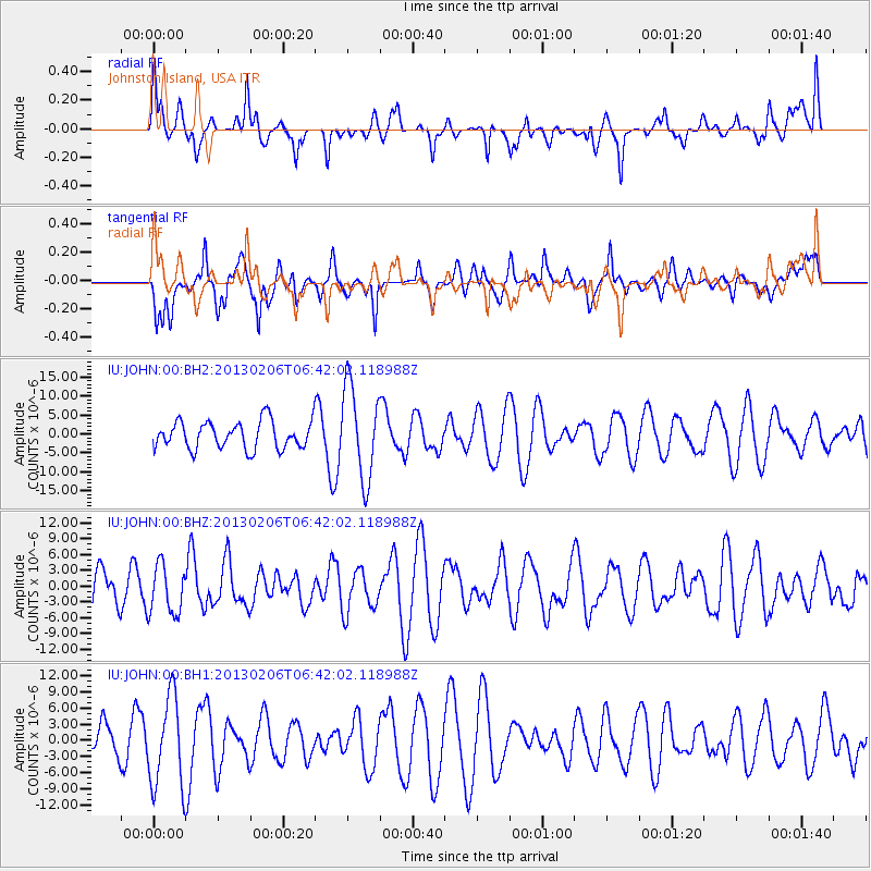
JOHN Johnston Island, USA - Earthquake Result Viewer
*The percent match for this event was below the threshold and hence no stack was calculated.
| Earthquake location: |
Santa Cruz Islands Region |
| Earthquake latitude/longitude: |
-10.8/164.6 |
| Earthquake time(UTC): |
2013/02/06 (037) 06:35:19 GMT |
| Earthquake Depth: |
10 km |
| Earthquake Magnitude: |
5.7 MB, 5.9 MS, 6.1 MW |
| Earthquake Catalog/Contributor: |
WHDF/NEIC |
|
| Network: |
IU Global Seismograph Network (GSN - IRIS/USGS) |
| Station: |
JOHN Johnston Island, USA |
| Lat/Lon: |
16.73 N/169.53 W |
| Elevation: |
2.0 m |
|
| Distance: |
37.5 deg |
| Az: |
43.494 deg |
| Baz: |
224.892 deg |
| Ray Param: |
$rayparam |
*The percent match for this event was below the threshold and hence was not used in the summary stack. |
|
| Radial Match: |
57.765785 % |
| Radial Bump: |
372 |
| Transverse Match: |
54.01191 % |
| Transverse Bump: |
400 |
| SOD ConfigId: |
558545 |
| Insert Time: |
2013-09-18 05:42:38.379 +0000 |
| GWidth: |
2.5 |
| Max Bumps: |
400 |
| Tol: |
0.001 |
|
Signal To Noise
| Channel | StoN | STA | LTA |
| IU:JOHN:00:BHZ:20130206T06:42:02.118988Z | 1.3370881 | 4.6414148E-6 | 3.4712855E-6 |
| IU:JOHN:00:BH1:20130206T06:42:02.118988Z | 1.3008982 | 8.409763E-6 | 6.464582E-6 |
| IU:JOHN:00:BH2:20130206T06:42:02.118988Z | 3.3696344 | 1.22095025E-5 | 3.6233907E-6 |
| Arrivals |
| Ps | |
| PpPs | |
| PsPs/PpSs | |


