DRLN Deer Lake, NFLD. - Earthquake Result Viewer
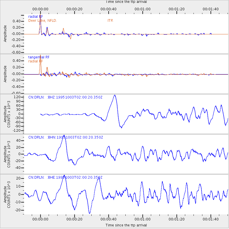
Earthquake location: Peru-Ecuador Border Region
Earthquake latitude/longitude: -2.8/-77.9
Earthquake time(UTC): 1995/10/03 (276) 01:51:24 GMT
Earthquake Depth: 27 km
Earthquake Magnitude: 6.5 MB, 7.0 MS, 6.9 UNKNOWN, 7.0 MW
Earthquake Catalog/Contributor: WHDF/NEIC
Network: CN Canadian National Seismograph Network
Station: DRLN Deer Lake, NFLD.
Lat/Lon: 49.26 N/57.50 W
Elevation: 238 m
Distance: 54.7 deg
Az: 16.224 deg
Baz: 205.21 deg
Ray Param: 0.06520708
Estimated Moho Depth: 31.5 km
Estimated Crust Vp/Vs: 1.77
Assumed Crust Vp: 6.35 km/s
Estimated Crust Vs: 3.583 km/s
Estimated Crust Poisson's Ratio: 0.27
Radial Match: 94.732445 %
Radial Bump: 257
Transverse Match: 88.18168 %
Transverse Bump: 400
SOD ConfigId: 6273
Insert Time: 2010-02-27 05:35:24.190 +0000
GWidth: 2.5
Max Bumps: 400
Tol: 0.001

Signal To Noise

ChannelStoNSTALTA
CN:DRLN: :BHN:19951003T02:00:20.350Z2.34164214221.14261802.642
CN:DRLN: :BHE:19951003T02:00:20.350Z2.88543134497.4341558.6697
CN:DRLN: :BHZ:19951003T02:00:20.350Z3.57985110179.7092843.6128
Arrivals
Ps4.0 SECOND
PpPs13 SECOND
PsPs/PpSs17 SECOND