You are here: Home > Network List > US - United States National Seismic Network Stations List
> Station HAWA Hanford, Washington, USA > Earthquake Result Viewer
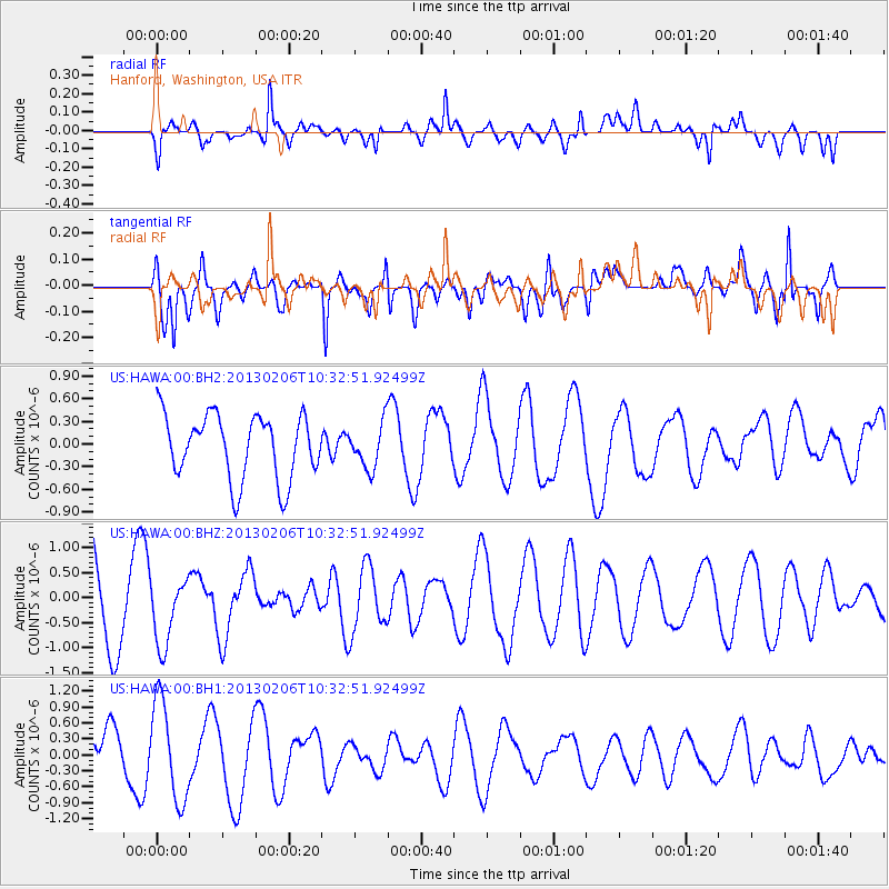
HAWA Hanford, Washington, USA - Earthquake Result Viewer
*The percent match for this event was below the threshold and hence no stack was calculated.
| Earthquake location: |
Santa Cruz Islands |
| Earthquake latitude/longitude: |
-10.9/165.3 |
| Earthquake time(UTC): |
2013/02/06 (037) 10:20:34 GMT |
| Earthquake Depth: |
10 km |
| Earthquake Magnitude: |
5.5 MB, 5.9 MS, 5.9 MW, 5.9 MW |
| Earthquake Catalog/Contributor: |
WHDF/NEIC |
|
| Network: |
US United States National Seismic Network |
| Station: |
HAWA Hanford, Washington, USA |
| Lat/Lon: |
46.39 N/119.53 W |
| Elevation: |
364 m |
|
| Distance: |
87.8 deg |
| Az: |
42.042 deg |
| Baz: |
251.89 deg |
| Ray Param: |
$rayparam |
*The percent match for this event was below the threshold and hence was not used in the summary stack. |
|
| Radial Match: |
58.697147 % |
| Radial Bump: |
400 |
| Transverse Match: |
72.921814 % |
| Transverse Bump: |
400 |
| SOD ConfigId: |
558545 |
| Insert Time: |
2013-09-18 05:48:23.430 +0000 |
| GWidth: |
2.5 |
| Max Bumps: |
400 |
| Tol: |
0.001 |
|
Signal To Noise
| Channel | StoN | STA | LTA |
| US:HAWA:00:BHZ:20130206T10:32:51.92499Z | 0.7896368 | 6.500456E-7 | 8.23221E-7 |
| US:HAWA:00:BH1:20130206T10:32:51.92499Z | 1.8288223 | 9.319864E-7 | 5.096102E-7 |
| US:HAWA:00:BH2:20130206T10:32:51.92499Z | 0.68275106 | 2.923526E-7 | 4.2819795E-7 |
| Arrivals |
| Ps | |
| PpPs | |
| PsPs/PpSs | |


