You are here: Home > Network List > US - United States National Seismic Network Stations List
> Station WUAZ Wupatki, Arizona, USA > Earthquake Result Viewer
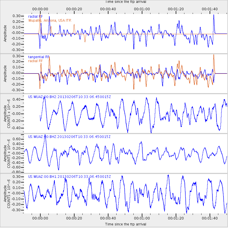
WUAZ Wupatki, Arizona, USA - Earthquake Result Viewer
*The percent match for this event was below the threshold and hence no stack was calculated.
| Earthquake location: |
Santa Cruz Islands |
| Earthquake latitude/longitude: |
-10.9/165.3 |
| Earthquake time(UTC): |
2013/02/06 (037) 10:20:34 GMT |
| Earthquake Depth: |
10 km |
| Earthquake Magnitude: |
5.5 MB, 5.9 MS, 5.9 MW, 5.9 MW |
| Earthquake Catalog/Contributor: |
WHDF/NEIC |
|
| Network: |
US United States National Seismic Network |
| Station: |
WUAZ Wupatki, Arizona, USA |
| Lat/Lon: |
35.52 N/111.37 W |
| Elevation: |
1592 m |
|
| Distance: |
90.9 deg |
| Az: |
54.136 deg |
| Baz: |
257.388 deg |
| Ray Param: |
$rayparam |
*The percent match for this event was below the threshold and hence was not used in the summary stack. |
|
| Radial Match: |
41.68436 % |
| Radial Bump: |
400 |
| Transverse Match: |
40.86296 % |
| Transverse Bump: |
400 |
| SOD ConfigId: |
558545 |
| Insert Time: |
2013-09-18 05:48:51.966 +0000 |
| GWidth: |
2.5 |
| Max Bumps: |
400 |
| Tol: |
0.001 |
|
Signal To Noise
| Channel | StoN | STA | LTA |
| US:WUAZ:00:BHZ:20130206T10:33:06.450015Z | 2.6701682 | 3.8683686E-7 | 1.448736E-7 |
| US:WUAZ:00:BH1:20130206T10:33:06.450015Z | 0.3316387 | 6.476492E-8 | 1.9528758E-7 |
| US:WUAZ:00:BH2:20130206T10:33:06.450015Z | 0.72505796 | 1.7133485E-7 | 2.3630503E-7 |
| Arrivals |
| Ps | |
| PpPs | |
| PsPs/PpSs | |


