You are here: Home > Network List > US - United States National Seismic Network Stations List
> Station LKWY Lake (Yellowstone--Lake), Wyoming, USA > Earthquake Result Viewer
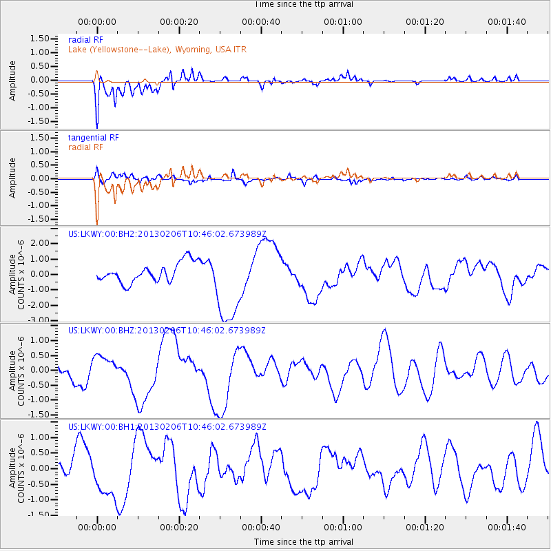
LKWY Lake (Yellowstone--Lake), Wyoming, USA - Earthquake Result Viewer
*The percent match for this event was below the threshold and hence no stack was calculated.
| Earthquake location: |
Santa Cruz Islands Region |
| Earthquake latitude/longitude: |
-10.6/164.8 |
| Earthquake time(UTC): |
2013/02/06 (037) 10:33:17 GMT |
| Earthquake Depth: |
10 km |
| Earthquake Magnitude: |
5.7 MB, 5.8 MS, 6.0 MW, 5.9 MW |
| Earthquake Catalog/Contributor: |
WHDF/NEIC |
|
| Network: |
US United States National Seismic Network |
| Station: |
LKWY Lake (Yellowstone--Lake), Wyoming, USA |
| Lat/Lon: |
44.57 N/110.40 W |
| Elevation: |
2424 m |
|
| Distance: |
93.7 deg |
| Az: |
45.513 deg |
| Baz: |
258.846 deg |
| Ray Param: |
$rayparam |
*The percent match for this event was below the threshold and hence was not used in the summary stack. |
|
| Radial Match: |
63.510597 % |
| Radial Bump: |
400 |
| Transverse Match: |
54.502148 % |
| Transverse Bump: |
400 |
| SOD ConfigId: |
558545 |
| Insert Time: |
2013-09-18 05:50:50.695 +0000 |
| GWidth: |
2.5 |
| Max Bumps: |
400 |
| Tol: |
0.001 |
|
Signal To Noise
| Channel | StoN | STA | LTA |
| US:LKWY:00:BHZ:20130206T10:46:02.673989Z | 1.0797384 | 4.3137442E-7 | 3.9951752E-7 |
| US:LKWY:00:BH1:20130206T10:46:02.673989Z | 2.6381295 | 7.4857957E-7 | 2.837539E-7 |
| US:LKWY:00:BH2:20130206T10:46:02.673989Z | 4.1716013 | 2.6353603E-6 | 6.317383E-7 |
| Arrivals |
| Ps | |
| PpPs | |
| PsPs/PpSs | |


